

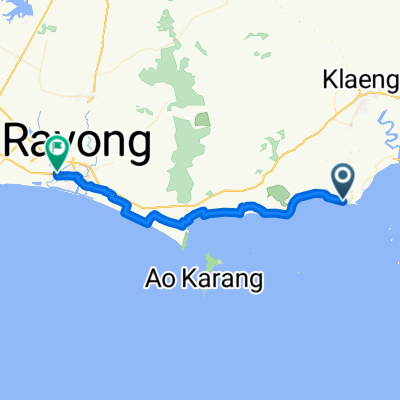
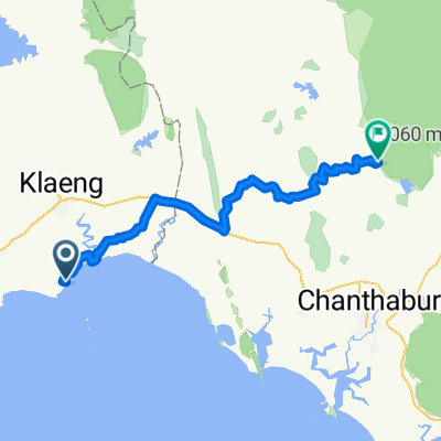
Rayong - Chantaburi
A cycling route starting in Klaeng, Rayong, Thailand.
Overview
About this route
-
Etappe Rayong - Chantaburi
(cloned from route 3310248)
- -:--
- Duration
- 91.5 km
- Distance
- 178 m
- Ascent
- 179 m
- Descent
- ---
- Avg. speed
- ---
- Max. altitude
Lissy
created this 10 years ago
Route quality
Waytypes & surfaces along the route
Waytypes
Quiet road
33 km
(36 %)
Road
20.1 km
(22 %)
Surfaces
Paved
23.8 km
(26 %)
Unpaved
2.7 km
(3 %)
Asphalt
16.5 km
(18 %)
Paved (undefined)
7.3 km
(8 %)
Continue with Bikemap
Use, edit, or download this cycling route
You would like to ride Rayong - Chantaburi or customize it for your own trip? Here is what you can do with this Bikemap route:
Free features
- Save this route as favorite or in collections
- Copy & plan your own version of this route
- Split it into stages to create a multi-day tour
- Sync your route with Garmin or Wahoo
Premium features
Free trial for 3 days, or one-time payment. More about Bikemap Premium.
- Navigate this route on iOS & Android
- Export a GPX / KML file of this route
- Create your custom printout (try it for free)
- Download this route for offline navigation
Discover more Premium features.
Get Bikemap PremiumFrom our community
Other popular routes starting in Klaeng
- Rayong - Chantaburi
- 91.5 km
- 178 m
- 179 m
- Klaeng, Rayong, Thailand
- Hop Inn Rayong
- 51.4 km
- 32 m
- 31 m
- Klaeng, Rayong, Thailand
- Recording from Mar 5, 2559 BE, 08:03
- 138.3 km
- 506 m
- 479 m
- Klaeng, Rayong, Thailand
- วันที่ 2
- 7.3 km
- 596 m
- 602 m
- Klaeng, Rayong, Thailand
- CTK Rock Garden - PN Khao Khitchakut
- 82.2 km
- 189 m
- 143 m
- Klaeng, Rayong, Thailand
- 2) Laem Maephim - Ban Chang
- 76.5 km
- 140 m
- 114 m
- Klaeng, Rayong, Thailand
- Rayong Prolog
- 77.8 km
- 282 m
- 285 m
- Klaeng, Rayong, Thailand


Open it in the app