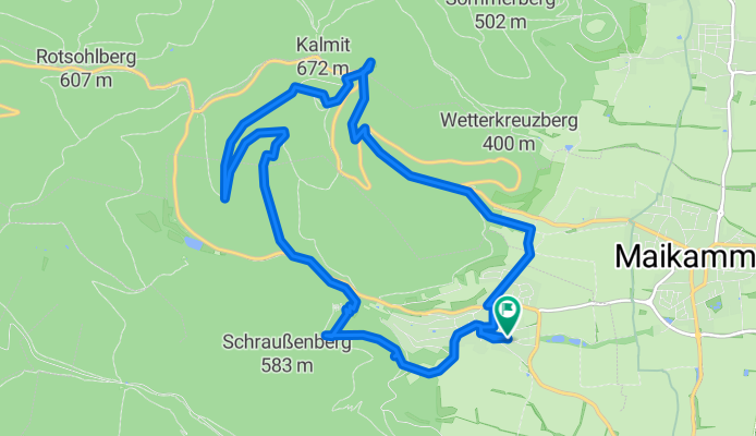

Einmal um den Kalmit CLONED FROM ROUTE 460255
- 12.4 km
- 392 m
- 392 m
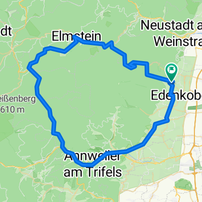
- Sankt Martin, Rhineland-Palatinate, Germany
A cycling route starting in Sankt Martin, Rhineland-Palatinate, Germany.
Overview
TEASI track
created this 10 years ago
Route highlights
05-MRZ-11 10:17:47
05-MRZ-11 13:48:26
05-MRZ-11 14:17:43
05-MRZ-11 15:22:49
05-MRZ-11 16:04:18
05-MRZ-11 17:36:35
Continue with Bikemap
You would like to ride 05-MRZ-11 or customize it for your own trip? Here is what you can do with this Bikemap route:
Free trial for 3 days, or one-time payment. More about Bikemap Premium.
Discover more Premium features.
Get Bikemap PremiumFrom our community
Open it in the app