

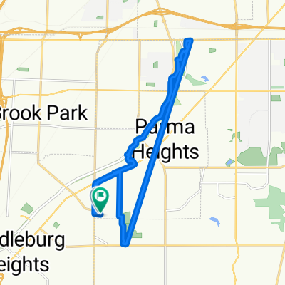
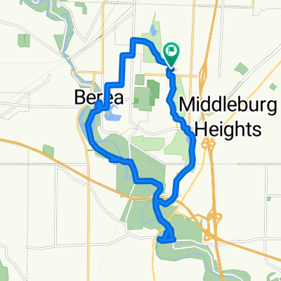
Pedal-to-the-Fest 2016
A cycling route starting in Middleburg Heights, Ohio, United States.
Overview
About this route
- -:--
- Duration
- 9.9 km
- Distance
- 42 m
- Ascent
- 64 m
- Descent
- ---
- Avg. speed
- ---
- Max. altitude
Route quality
Waytypes & surfaces along the route
Waytypes
Road
5.8 km
(58 %)
Path
1.6 km
(16 %)
Surfaces
Paved
5.2 km
(53 %)
Asphalt
5.1 km
(51 %)
Wood
0.2 km
(2 %)
Undefined
4.7 km
(47 %)
Continue with Bikemap
Use, edit, or download this cycling route
You would like to ride Pedal-to-the-Fest 2016 or customize it for your own trip? Here is what you can do with this Bikemap route:
Free features
- Save this route as favorite or in collections
- Copy & plan your own version of this route
- Sync your route with Garmin or Wahoo
Premium features
Free trial for 3 days, or one-time payment. More about Bikemap Premium.
- Navigate this route on iOS & Android
- Export a GPX / KML file of this route
- Create your custom printout (try it for free)
- Download this route for offline navigation
Discover more Premium features.
Get Bikemap PremiumFrom our community
Other popular routes starting in Middleburg Heights
 W 130th St, Parma Heights to W 130th St, Parma Heights
- Distance
- 18.2 km
- Ascent
- 55 m
- Descent
- 59 m
- Location
- Middleburg Heights, Ohio, United States
 13672 Trenton Trail, Middleburg Heights to 13673 Trenton Trail, Middleburg Heights
- Distance
- 2 km
- Ascent
- 3 m
- Descent
- 3 m
- Location
- Middleburg Heights, Ohio, United States
 W 130th St, Parma Heights to W 130th St, Parma Heights
- Distance
- 19.5 km
- Ascent
- 89 m
- Descent
- 91 m
- Location
- Middleburg Heights, Ohio, United States
 Restful route in Middleburg Heights
- Distance
- 4.7 km
- Ascent
- 51 m
- Descent
- 30 m
- Location
- Middleburg Heights, Ohio, United States
 7518–7550 Gerald Dr, Middleburg Heights to 13701 Trenton Trail, Middleburg Heights
- Distance
- 3.3 km
- Ascent
- 27 m
- Descent
- 19 m
- Location
- Middleburg Heights, Ohio, United States
 ride through Middleburg Heights
- Distance
- 17.7 km
- Ascent
- 74 m
- Descent
- 71 m
- Location
- Middleburg Heights, Ohio, United States
 Bagley Road 18590, Cleveland to Bagley Road 18324, Middleburg Heights
- Distance
- 23.7 km
- Ascent
- 21 m
- Descent
- 23 m
- Location
- Middleburg Heights, Ohio, United States
 train depot
- Distance
- 7.7 km
- Ascent
- 37 m
- Descent
- 55 m
- Location
- Middleburg Heights, Ohio, United States
Open it in the app