
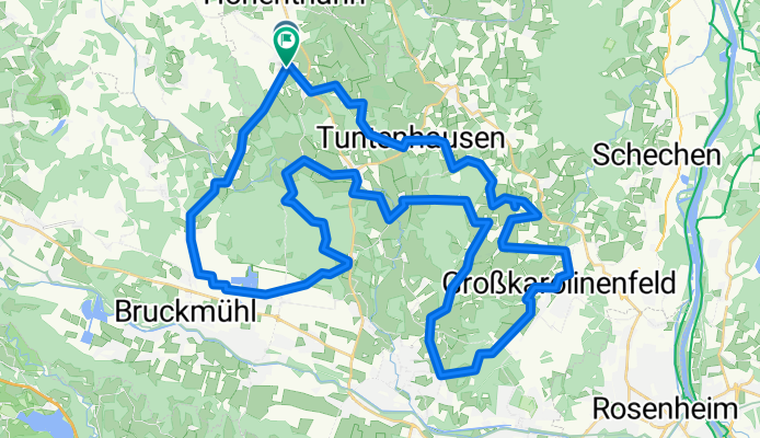
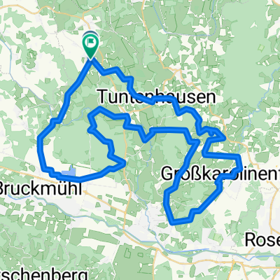
Um Biberg und Tuntenhausen
A cycling route starting in Tuntenhausen, Bavaria, Germany.
Overview
About this route
- -:--
- Duration
- 59.1 km
- Distance
- 220 m
- Ascent
- 224 m
- Descent
- ---
- Avg. speed
- ---
- Max. altitude

Route quality
Waytypes & surfaces along the route
Waytypes
Quiet road
39 km
(66 %)
Track
10 km
(17 %)
Surfaces
Paved
46.7 km
(79 %)
Unpaved
8.9 km
(15 %)
Asphalt
46.7 km
(79 %)
Gravel
4.1 km
(7 %)
Continue with Bikemap
Use, edit, or download this cycling route
You would like to ride Um Biberg und Tuntenhausen or customize it for your own trip? Here is what you can do with this Bikemap route:
Free features
- Save this route as favorite or in collections
- Copy & plan your own version of this route
- Sync your route with Garmin or Wahoo
Premium features
Free trial for 3 days, or one-time payment. More about Bikemap Premium.
- Navigate this route on iOS & Android
- Export a GPX / KML file of this route
- Create your custom printout (try it for free)
- Download this route for offline navigation
Discover more Premium features.
Get Bikemap PremiumFrom our community
Other popular routes starting in Tuntenhausen
 Tuntenhausen Wolfersberg Neuperlach
- Distance
- 41.8 km
- Ascent
- 355 m
- Descent
- 300 m
- Location
- Tuntenhausen, Bavaria, Germany
 Gemeinderundweg Tuntenhausen - Gemeinderundweg Tuntenhausen
- Distance
- 37.6 km
- Ascent
- 407 m
- Descent
- 409 m
- Location
- Tuntenhausen, Bavaria, Germany
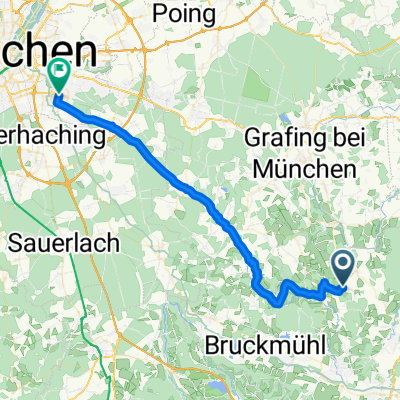 Von Tuntenhausen nach München/Neuperlach
- Distance
- 42.5 km
- Ascent
- 363 m
- Descent
- 321 m
- Location
- Tuntenhausen, Bavaria, Germany
 Um Biberg und Tuntenhausen
- Distance
- 59.1 km
- Ascent
- 220 m
- Descent
- 224 m
- Location
- Tuntenhausen, Bavaria, Germany
 neue Feierabendrunde
- Distance
- 24.2 km
- Ascent
- 223 m
- Descent
- 220 m
- Location
- Tuntenhausen, Bavaria, Germany
 20.06.11 Frohnleichnamstour
- Distance
- 49.6 km
- Ascent
- 314 m
- Descent
- 303 m
- Location
- Tuntenhausen, Bavaria, Germany
 Rainer Straße nach B15
- Distance
- 29.1 km
- Ascent
- 72 m
- Descent
- 169 m
- Location
- Tuntenhausen, Bavaria, Germany
 Mangfalltal
- Distance
- 52.9 km
- Ascent
- 189 m
- Descent
- 194 m
- Location
- Tuntenhausen, Bavaria, Germany
Open it in the app