

NP LEJOG 2016 - Complete route
A cycling route starting in Penzance, England, United Kingdom.
Overview
About this route
Complete Land's End to John o' Groats route.
April 2016.
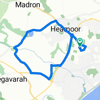
From Penzance YHA to Wick. Via YHAs, hostels, B&Bs and hotels.
17 individual days also available:
Day 1: https://www.bikemap.net/en/route/3493970-lejog-day-1-penzance-lands-end-treyarnon/
Day 2: https://www.bikemap.net/en/route/3493976-lejog-day-2-treyarnon-okehampton/
Day 3: https://www.bikemap.net/en/route/3493982-lejog-day-3-okehampton-wellington/
Day 4: https://www.bikemap.net/en/route/3494006-lejog-day-4-wellington-to-bristol/
Day 5: https://www.bikemap.net/en/route/3494013-lejog-day-5-bristol-to-welsh-bicknor/
Day 6: https://www.bikemap.net/en/route/3494044-lejog-day-6-welsh-bicknor-to-longville-in-the-dale/
Day 7: https://www.bikemap.net/en/route/3494049-lejog-day-7-longville-in-the-dale-to-chester/
Day 8: https://www.bikemap.net/en/route/3494065-lejog-day-8-chester-to-garstang/
Day 9: https://www.bikemap.net/en/route/3494075-lejog-day-9-garstang-to-penrith/
Day 10: https://www.bikemap.net/en/route/3494085-lejog-day-10-penrith-to-lanark/
Day 11: https://www.bikemap.net/en/route/3494092-lejog-day-11-lanark-to-lochranza/
Day 12: https://www.bikemap.net/en/route/3494099-lejog-day-12-lochranza-to-oban/
Day 13: https://www.bikemap.net/en/route/3494115-lejog-day-13-oban-to-fort-william/
Day 14: https://www.bikemap.net/en/route/3494107-lejog-day-14-fort-william-to-drumnadrochit/
Day 15: https://www.bikemap.net/en/route/3494128-lejog-day-15-drumnadrochit-to-invershin/
Day 16: https://www.bikemap.net/en/route/3494133-lejog-day-16-invershin-to-tongue/
Day 17: https://www.bikemap.net/en/route/3494139-lejog-day-17-tongue-to-john-o-groats-to-wick/
Day 1: Penzance - Land's End - Treyarnon
Day 2: Okehampton
Day 3: Wellington
Day 4: Bristol
Day 5: Welsh Bicknor
Day 6: Longville in the Dale
Day 7: Chester
Day 8: Garstang
Day 9: Penrith
Day 10: Lanark
Day 11: Lochranza
Day 12: Oban
Day 13: Fort William
Day 14: Drumnadrochit
Day 15: Invershin
Day 16: Tongue
Day 17: Tongue - John o' Groats - Wick
To turn this into a 15-day route, combine days 3 and 4, or 4 and 5, to make a long, but mostly very flat, day with a couple of big hills. Alternatively days 5 and 6 could be combined. You could also combine days 13 and 14 - again for a long, but predominately flat and easy, day.
Day 10 (Penrith to Lanark) is long, although there are no difficult climbs. You could shorten it by starting at Carlisle, or opt - somehow - for a more direct route to Arran with a break halfway. Accommodation options in this area are limited, though.
- -:--
- Duration
- 1,629 km
- Distance
- 1,892 m
- Ascent
- 1,931 m
- Descent
- ---
- Avg. speed
- ---
- Max. altitude
Continue with Bikemap
Use, edit, or download this cycling route
You would like to ride NP LEJOG 2016 - Complete route or customize it for your own trip? Here is what you can do with this Bikemap route:
Free features
- Save this route as favorite or in collections
- Copy & plan your own version of this route
- Split it into stages to create a multi-day tour
- Sync your route with Garmin or Wahoo
Premium features
Free trial for 3 days, or one-time payment. More about Bikemap Premium.
- Navigate this route on iOS & Android
- Export a GPX / KML file of this route
- Create your custom printout (try it for free)
- Download this route for offline navigation
Discover more Premium features.
Get Bikemap PremiumFrom our community
Other popular routes starting in Penzance
 Day 2 Penzance to Boscastle
- Distance
- 108 km
- Ascent
- 780 m
- Descent
- 533 m
- Location
- Penzance, England, United Kingdom
 Day 1 Penzance to Penzance Prologue
- Distance
- 36.1 km
- Ascent
- 364 m
- Descent
- 364 m
- Location
- Penzance, England, United Kingdom
 penzance to tintagel
- Distance
- 113.9 km
- Ascent
- 777 m
- Descent
- 736 m
- Location
- Penzance, England, United Kingdom
 Lejog 04 - 01: Penzance - Lands End - Penzance - Golant YH
- Distance
- 116.7 km
- Ascent
- 842 m
- Descent
- 869 m
- Location
- Penzance, England, United Kingdom
 Penzance to St Just
- Distance
- 14.3 km
- Ascent
- 254 m
- Descent
- 141 m
- Location
- Penzance, England, United Kingdom
 PZ Tri run route
- Distance
- 6.4 km
- Ascent
- 71 m
- Descent
- 70 m
- Location
- Penzance, England, United Kingdom
 E2E Northern Cornwall
- Distance
- 616.9 km
- Ascent
- 1,462 m
- Descent
- 1,452 m
- Location
- Penzance, England, United Kingdom
 PZ Tri bike route
- Distance
- 27.1 km
- Ascent
- 292 m
- Descent
- 292 m
- Location
- Penzance, England, United Kingdom
Open it in the app