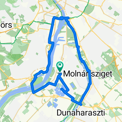
Kamaraerdő - Budaörs - Budai hegyek - Dobogókő
A cycling route starting in Budapest XXII. kerület, Budapest, Hungary.
Overview
About this route
Kamarerdő - Budaörs - Jánoshegy - Hárshegy - Hármashatárhegy - Csúcshegy - Üröm - Kevély nyereg - Hosszúhegy - S+ Dobogókőre
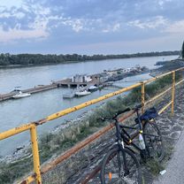
Az Ezüst Kevély nyereg nehezen bringázható/tolós helyenként, de lekerülhető az északi oldalon, cserébe a kilátásért :)
- -:--
- Duration
- 61.2 km
- Distance
- 1,361 m
- Ascent
- 864 m
- Descent
- ---
- Avg. speed
- ---
- Max. altitude
Route quality
Waytypes & surfaces along the route
Waytypes
Track
27.5 km
(45 %)
Path
17.4 km
(28 %)
Surfaces
Paved
13.8 km
(22 %)
Unpaved
36.5 km
(60 %)
Ground
19.8 km
(32 %)
Gravel
13.4 km
(22 %)
Continue with Bikemap
Use, edit, or download this cycling route
You would like to ride Kamaraerdő - Budaörs - Budai hegyek - Dobogókő or customize it for your own trip? Here is what you can do with this Bikemap route:
Free features
- Save this route as favorite or in collections
- Copy & plan your own version of this route
- Sync your route with Garmin or Wahoo
Premium features
Free trial for 3 days, or one-time payment. More about Bikemap Premium.
- Navigate this route on iOS & Android
- Export a GPX / KML file of this route
- Create your custom printout (try it for free)
- Download this route for offline navigation
Discover more Premium features.
Get Bikemap PremiumFrom our community
Other popular routes starting in Budapest XXII. kerület
- Csepeli-kör
- Distance
- 58.1 km
- Ascent
- 175 m
- Descent
- 173 m
- Location
- Budapest XXII. kerület, Budapest, Hungary
- Sziget-kör
- Distance
- 66.6 km
- Ascent
- 144 m
- Descent
- 141 m
- Location
- Budapest XXII. kerület, Budapest, Hungary
- Velence 7A - 7-es körút
- Distance
- 114.5 km
- Ascent
- 681 m
- Descent
- 682 m
- Location
- Budapest XXII. kerület, Budapest, Hungary
- Csepeli út 6, Szigetszentmiklós to Csepeli út 38, Szigetszentmiklós
- Distance
- 43.5 km
- Ascent
- 359 m
- Descent
- 352 m
- Location
- Budapest XXII. kerület, Budapest, Hungary
- Borkő utca 18, Budapest to Velence, Lidó
- Distance
- 67.3 km
- Ascent
- 605 m
- Descent
- 621 m
- Location
- Budapest XXII. kerület, Budapest, Hungary
- Bp-Budaörs-Biatorbágy-Sóskút-Érd-Bp
- Distance
- 49.3 km
- Ascent
- 246 m
- Descent
- 235 m
- Location
- Budapest XXII. kerület, Budapest, Hungary
- János-hegy-Zsámbék túrakör
- Distance
- 81.9 km
- Ascent
- 601 m
- Descent
- 602 m
- Location
- Budapest XXII. kerület, Budapest, Hungary
- Moderate route in Budapest XXII. kerület
- Distance
- 24 km
- Ascent
- 1,086 m
- Descent
- 1,054 m
- Location
- Budapest XXII. kerület, Budapest, Hungary
Open it in the app