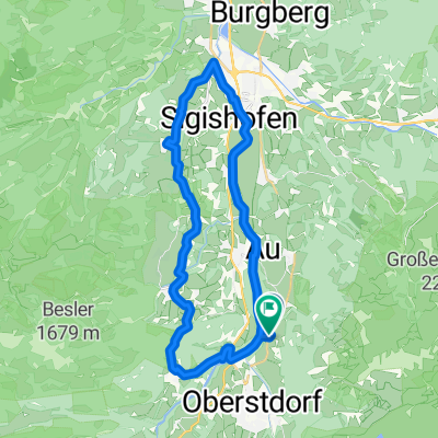
32km-Rohrmoostal-Engenkopfrunde
A cycling route starting in Oberstdorf, Bavaria, Germany.
Overview
About this route
Technically straightforward but physically demanding circular route through the Rohrmoostal and around the Engenkopf. Lots of asphalt, so doable even in bad weather. Steep descents, good disc brakes are essential. Tip: stop at Dornach-Alpe with panoramic views over the valley.
- -:--
- Duration
- 31.6 km
- Distance
- 560 m
- Ascent
- 559 m
- Descent
- ---
- Avg. speed
- ---
- Max. altitude
Route quality
Waytypes & surfaces along the route
Waytypes
Quiet road
17.1 km
(54 %)
Track
5.4 km
(17 %)
Surfaces
Paved
27.2 km
(86 %)
Unpaved
4.1 km
(13 %)
Asphalt
27.2 km
(86 %)
Gravel
4.1 km
(13 %)
Undefined
0.3 km
(1 %)
Route highlights
Points of interest along the route

Point of interest after 23.1 km
Alpe Dornach
Continue with Bikemap
Use, edit, or download this cycling route
You would like to ride 32km-Rohrmoostal-Engenkopfrunde or customize it for your own trip? Here is what you can do with this Bikemap route:
Free features
- Save this route as favorite or in collections
- Copy & plan your own version of this route
- Sync your route with Garmin or Wahoo
Premium features
Free trial for 3 days, or one-time payment. More about Bikemap Premium.
- Navigate this route on iOS & Android
- Export a GPX / KML file of this route
- Create your custom printout (try it for free)
- Download this route for offline navigation
Discover more Premium features.
Get Bikemap PremiumFrom our community
Other popular routes starting in Oberstdorf
 Von Oberstdorf bis Sibratsgfäll
- Distance
- 17.8 km
- Ascent
- 526 m
- Descent
- 457 m
- Location
- Oberstdorf, Bavaria, Germany
 iller - Donautal 1.tag
- Distance
- 64.6 km
- Ascent
- 126 m
- Descent
- 224 m
- Location
- Oberstdorf, Bavaria, Germany
 Oberstdorf - Rohrmoos
- Distance
- 25.9 km
- Ascent
- 449 m
- Descent
- 513 m
- Location
- Oberstdorf, Bavaria, Germany
 Runde zum großen Alpsee
- Distance
- 86.1 km
- Ascent
- 795 m
- Descent
- 864 m
- Location
- Oberstdorf, Bavaria, Germany
 Tiefenbach - Immenstadt - Oberstdorf - Tiefenbach
- Distance
- 60.6 km
- Ascent
- 345 m
- Descent
- 343 m
- Location
- Oberstdorf, Bavaria, Germany
 Rubi über Hörnerdörfer zurück
- Distance
- 31.1 km
- Ascent
- 532 m
- Descent
- 536 m
- Location
- Oberstdorf, Bavaria, Germany
 Kornau - Söllereck - Riezlern - Breitach
- Distance
- 18.2 km
- Ascent
- 775 m
- Descent
- 778 m
- Location
- Oberstdorf, Bavaria, Germany
 Alpencross 2010 | Etappe 1
- Distance
- 59.3 km
- Ascent
- 1,978 m
- Descent
- 2,017 m
- Location
- Oberstdorf, Bavaria, Germany
Open it in the app


