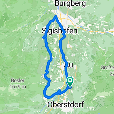
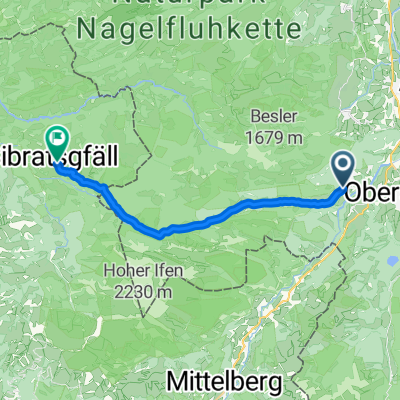
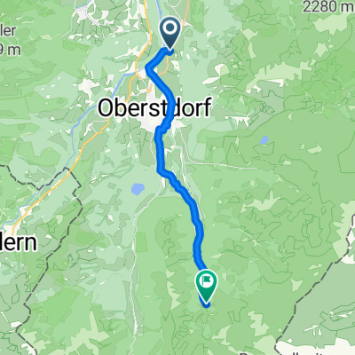
42km-Oberstdorf-Hindelang
A cycling route starting in Oberstdorf, Bavaria, Germany.
Overview
About this route
MTB-Tour fernab der Hauptverkehrsstraßen. Technisch einfach aber konditionell fordernd. Oberstdorf nach HIndelang und zurück jeweils über am Hang liegende Nebenstrecken, echt ein Erlebnis und man entdeckt viel neues. Der Geländeeinschnitt vor Imberg lässt sich leider nur schiebend/tragend machen, allerdings ist das in wenigen Minuten erledigt.
- -:--
- Duration
- 41.8 km
- Distance
- 395 m
- Ascent
- 395 m
- Descent
- ---
- Avg. speed
- ---
- Max. altitude
Route quality
Waytypes & surfaces along the route
Waytypes
Quiet road
14.6 km
(35 %)
Path
13.4 km
(32 %)
Surfaces
Paved
19.2 km
(46 %)
Unpaved
14.2 km
(34 %)
Asphalt
18.8 km
(45 %)
Gravel
12.1 km
(29 %)
Continue with Bikemap
Use, edit, or download this cycling route
You would like to ride 42km-Oberstdorf-Hindelang or customize it for your own trip? Here is what you can do with this Bikemap route:
Free features
- Save this route as favorite or in collections
- Copy & plan your own version of this route
- Sync your route with Garmin or Wahoo
Premium features
Free trial for 3 days, or one-time payment. More about Bikemap Premium.
- Navigate this route on iOS & Android
- Export a GPX / KML file of this route
- Create your custom printout (try it for free)
- Download this route for offline navigation
Discover more Premium features.
Get Bikemap PremiumFrom our community
Other popular routes starting in Oberstdorf
- Oberstdorf - Rohrmoostal - Lecknertal
- Distance
- 74.8 km
- Ascent
- 1,190 m
- Descent
- 1,190 m
- Location
- Oberstdorf, Bavaria, Germany
- Balderschwang Riedbergpass
- Distance
- 50.1 km
- Ascent
- 1,065 m
- Descent
- 1,065 m
- Location
- Oberstdorf, Bavaria, Germany
- Illerradweg
- Distance
- 145.8 km
- Ascent
- 342 m
- Descent
- 676 m
- Location
- Oberstdorf, Bavaria, Germany
- Transalp Oberstdorf - Stilfserjoch - Laas
- Distance
- 289.9 km
- Ascent
- 7,211 m
- Descent
- 7,110 m
- Location
- Oberstdorf, Bavaria, Germany
- Oberstdorf - Königsträßchen
- Distance
- 64.7 km
- Ascent
- 785 m
- Descent
- 785 m
- Location
- Oberstdorf, Bavaria, Germany
- MTB Oberstdorf - DAY_5 (6_2009) - Kanzelwand
- Distance
- 43.4 km
- Ascent
- 1,377 m
- Descent
- 1,377 m
- Location
- Oberstdorf, Bavaria, Germany
- 7) Radtour Kleinwalsertal
- Distance
- 34.1 km
- Ascent
- 899 m
- Descent
- 902 m
- Location
- Oberstdorf, Bavaria, Germany
- Breitach Kleinwalsertal
- Distance
- 33.9 km
- Ascent
- 715 m
- Descent
- 709 m
- Location
- Oberstdorf, Bavaria, Germany
Open it in the app