

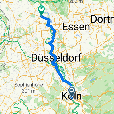
Rund um Köln 2010
A cycling route starting in Altstadt Sud, North Rhine-Westphalia, Germany.
Overview
About this route
- -:--
- Duration
- 67.2 km
- Distance
- 488 m
- Ascent
- 482 m
- Descent
- ---
- Avg. speed
- 254 m
- Max. altitude
Route quality
Waytypes & surfaces along the route
Waytypes
Path
14.1 km
(21 %)
Quiet road
8.1 km
(12 %)
Surfaces
Paved
53.1 km
(79 %)
Unpaved
2 km
(3 %)
Asphalt
51.1 km
(76 %)
Paved (undefined)
1.3 km
(2 %)
Continue with Bikemap
Use, edit, or download this cycling route
You would like to ride Rund um Köln 2010 or customize it for your own trip? Here is what you can do with this Bikemap route:
Free features
- Save this route as favorite or in collections
- Copy & plan your own version of this route
- Sync your route with Garmin or Wahoo
Premium features
Free trial for 3 days, or one-time payment. More about Bikemap Premium.
- Navigate this route on iOS & Android
- Export a GPX / KML file of this route
- Create your custom printout (try it for free)
- Download this route for offline navigation
Discover more Premium features.
Get Bikemap PremiumFrom our community
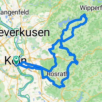
Other popular routes starting in Altstadt Sud
 Köln - Rheinberg
- Distance
- 100.4 km
- Ascent
- 265 m
- Descent
- 289 m
- Location
- Altstadt Sud, North Rhine-Westphalia, Germany
 Kaiserbahnhof Kierberg
- Distance
- 38.5 km
- Ascent
- 116 m
- Descent
- 110 m
- Location
- Altstadt Sud, North Rhine-Westphalia, Germany
 Rund um Köln 2025 - Velodom 120 (120,8km)
- Distance
- 120.6 km
- Ascent
- 1,481 m
- Descent
- 1,477 m
- Location
- Altstadt Sud, North Rhine-Westphalia, Germany
 Kölner Botanischer-Gärten
- Distance
- 34 km
- Ascent
- 80 m
- Descent
- 79 m
- Location
- Altstadt Sud, North Rhine-Westphalia, Germany
 Kölner_Südwestlicher Regionen
- Distance
- 34 km
- Ascent
- 89 m
- Descent
- 91 m
- Location
- Altstadt Sud, North Rhine-Westphalia, Germany
 Einmal ummen Airport
- Distance
- 50.4 km
- Ascent
- 130 m
- Descent
- 131 m
- Location
- Altstadt Sud, North Rhine-Westphalia, Germany
 KEV Wanderheim Bugelaul
- Distance
- 51.4 km
- Ascent
- 73 m
- Descent
- 41 m
- Location
- Altstadt Sud, North Rhine-Westphalia, Germany
 auf den Spuren des preußischen Kölns – im Rechtsrheinischen
- Distance
- 34.2 km
- Ascent
- 88 m
- Descent
- 100 m
- Location
- Altstadt Sud, North Rhine-Westphalia, Germany
Open it in the app