

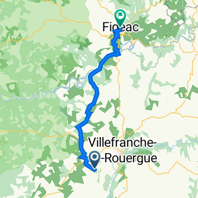
2016 Ride Day 168 - Villefranche-de-Rouergue Circle through Najac
A cycling route starting in Villefranche-de-Rouergue, Occitanie, France.
Overview
About this route
This was a wonderful ride south along D922, then through Najac and back to Villefranche along D47. All excellent zero and low traffic roads. Only within Villefranche were there any cars.
- -:--
- Duration
- 50.5 km
- Distance
- 761 m
- Ascent
- 761 m
- Descent
- ---
- Avg. speed
- ---
- Max. altitude

Route photos


Route quality
Waytypes & surfaces along the route
Waytypes
Road
21.7 km
(43 %)
Quiet road
10.1 km
(20 %)
Surfaces
Paved
13.1 km
(26 %)
Asphalt
13.1 km
(26 %)
Undefined
37.4 km
(74 %)
Continue with Bikemap
Use, edit, or download this cycling route
You would like to ride 2016 Ride Day 168 - Villefranche-de-Rouergue Circle through Najac or customize it for your own trip? Here is what you can do with this Bikemap route:
Free features
- Save this route as favorite or in collections
- Copy & plan your own version of this route
- Sync your route with Garmin or Wahoo
Premium features
Free trial for 3 days, or one-time payment. More about Bikemap Premium.
- Navigate this route on iOS & Android
- Export a GPX / KML file of this route
- Create your custom printout (try it for free)
- Download this route for offline navigation
Discover more Premium features.
Get Bikemap PremiumFrom our community
Other popular routes starting in Villefranche-de-Rouergue
 Combenegre Aveyron Lezert
- Distance
- 23.4 km
- Ascent
- 493 m
- Descent
- 497 m
- Location
- Villefranche-de-Rouergue, Occitanie, France
 Door to Door day 13 Villefranche de Rouergue - Bruniquel 23rd Sept
- Distance
- 58 km
- Ascent
- 723 m
- Descent
- 963 m
- Location
- Villefranche-de-Rouergue, Occitanie, France
 Villefranche-de-Rouergue - Circle through St Grat, Castanet, and Monteils
- Distance
- 53.1 km
- Ascent
- 708 m
- Descent
- 707 m
- Location
- Villefranche-de-Rouergue, Occitanie, France
 La Rouquette to 26 Rue d'Aujou, Figeac
- Distance
- 47.6 km
- Ascent
- 839 m
- Descent
- 1,008 m
- Location
- Villefranche-de-Rouergue, Occitanie, France
 Dordogne 20130713
- Distance
- 94.8 km
- Ascent
- 812 m
- Descent
- 952 m
- Location
- Villefranche-de-Rouergue, Occitanie, France
 2014 Ride Day 89 - Villefranche-de-Rouergue to Cahors
- Distance
- 81.4 km
- Ascent
- 356 m
- Descent
- 491 m
- Location
- Villefranche-de-Rouergue, Occitanie, France
 2016 Ride Day 169 - Villefranche-de-Rouergue to Montauban
- Distance
- 112.4 km
- Ascent
- 971 m
- Descent
- 1,125 m
- Location
- Villefranche-de-Rouergue, Occitanie, France
 Od Dordogne do Provence 5.etapa
- Distance
- 73.9 km
- Ascent
- 507 m
- Descent
- 646 m
- Location
- Villefranche-de-Rouergue, Occitanie, France
Open it in the app