

Cycling in Seoul: along the Han river
A cycling route starting in Seoul, Seoul, South Korea.
Overview
About this route
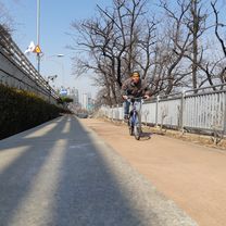
Start from one of the bicycle rental stations in Yeouido Hangang Park. Cross the Han over the Mapo Bridge, keep left and look for the blue ramp that takes you down to the river. Continue westwards until you meet Yanghwa Bridge. Carry your bike up the steps at the bridge and cycle across until the exit for Seonyudo Park. There's a café at the west end of the island. Continue across Yanghwa Bridge, there is a bike elevator to take you back down to the river. Cycle eastwards, past the Seoul Marina and the National Assembly Hall, until you are in Yeouido Hangang Park once again.
- -:--
- Duration
- 13.1 km
- Distance
- 137 m
- Ascent
- 137 m
- Descent
- ---
- Avg. speed
- ---
- Max. altitude

Route highlights
Points of interest along the route
Drinking water after 0 km
Drinking water fountain
Point of interest after 0 km
Bicycle rental station
Point of interest after 1.4 km
Bicycle rental station
Point of interest after 11.7 km
Bicycle rental station
Continue with Bikemap
Use, edit, or download this cycling route
You would like to ride Cycling in Seoul: along the Han river or customize it for your own trip? Here is what you can do with this Bikemap route:
Free features
- Save this route as favorite or in collections
- Copy & plan your own version of this route
- Sync your route with Garmin or Wahoo
Premium features
Free trial for 3 days, or one-time payment. More about Bikemap Premium.
- Navigate this route on iOS & Android
- Export a GPX / KML file of this route
- Create your custom printout (try it for free)
- Download this route for offline navigation
Discover more Premium features.
Get Bikemap PremiumFrom our community
Other popular routes starting in Seoul
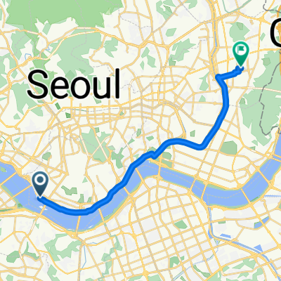
 Radtour Korea Oktober 2012
- Distance
- 801.5 km
- Ascent
- 3,285 m
- Descent
- 3,252 m
- Location
- Seoul, Seoul, South Korea
 장안동 416번지 ~ 면목동
- Distance
- 5.4 km
- Ascent
- 70 m
- Descent
- 78 m
- Location
- Seoul, Seoul, South Korea
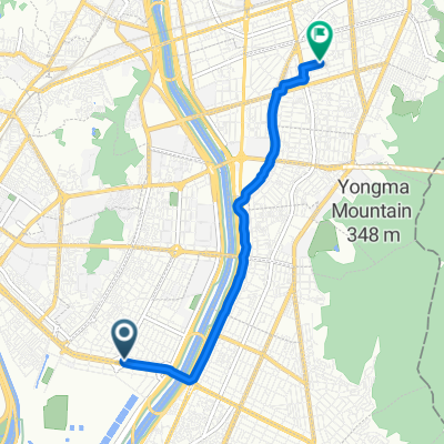
 Seoul to Guri City
- Distance
- 30.7 km
- Ascent
- 251 m
- Descent
- 244 m
- Location
- Seoul, Seoul, South Korea
 zeppelin_viaggiamondo_corea_2013
- Distance
- 835.5 km
- Ascent
- 5,814 m
- Descent
- 5,824 m
- Location
- Seoul, Seoul, South Korea
 HRR 2016 Season opner + climb
- Distance
- 79 km
- Ascent
- 329 m
- Descent
- 327 m
- Location
- Seoul, Seoul, South Korea
 Seoul-Busan V2013
- Distance
- 435.8 km
- Ascent
- 1,043 m
- Descent
- 1,036 m
- Location
- Seoul, Seoul, South Korea
 ride from Yongsan-gu to Seongnamsi
- Distance
- 27.7 km
- Ascent
- 87 m
- Descent
- 87 m
- Location
- Seoul, Seoul, South Korea
 보통 경로
보통 경로- Distance
- 19.6 km
- Ascent
- 94 m
- Descent
- 97 m
- Location
- Seoul, Seoul, South Korea
Open it in the app