


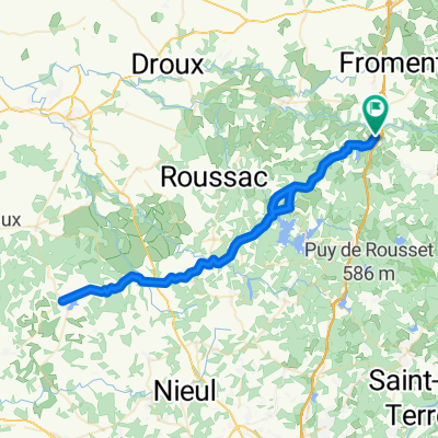
Bessines-Cerilly
A cycling route starting in Bessines-sur-Gartempe, Nouvelle-Aquitaine, France.
Overview
About this route
0
- -:--
- Duration
- 154.4 km
- Distance
- 713 m
- Ascent
- 707 m
- Descent
- ---
- Avg. speed
- ---
- Max. altitude
toniokrem
created this 9 years ago
Route quality
Waytypes & surfaces along the route
Waytypes
Road
95.7 km
62 %
Quiet road
35.5 km
23 %
Undefined
23.2 km
15 %
Surfaces
Paved
32.4 km
(21 %)
Asphalt
32.4 km
21 %
Undefined
122 km
79 %
Continue with Bikemap
Use, edit, or download this cycling route
You would like to ride Bessines-Cerilly or customize it for your own trip? Here is what you can do with this Bikemap route:
Free features
- Save this route as favorite or in collections
- Copy & plan your own version of this route
- Split it into stages to create a multi-day tour
- Sync your route with Garmin or Wahoo
Premium features
Free trial for 3 days, or one-time payment. More about Bikemap Premium.
- Navigate this route on iOS & Android
- Export a GPX / KML file of this route
- Create your custom printout (try it for free)
- Download this route for offline navigation
Discover more Premium features.
Get Bikemap PremiumFrom our community
Other popular routes starting in Bessines-sur-Gartempe

 4 Brancjes du Bois des Echelles 53 km 1230m D+1
- 53.6 km
- 1,066 m
- 1,066 m
- Bessines-sur-Gartempe, Nouvelle-Aquitaine, France
 8–28 Rue de la Trappe, Saint-Sulpice-Laurière à 9 Route de la Couture, Laurière0
- 3.6 km
- 453 m
- 44 m
- Bessines-sur-Gartempe, Nouvelle-Aquitaine, France
 55 km par La Jonchère La Crouzille St Léger0
- 56.1 km
- 702 m
- 703 m
- Bessines-sur-Gartempe, Nouvelle-Aquitaine, France
 12 Route de Gaudeix, Saint-Sulpice-Laurière à 56 Rue de la Trappe, Saint-Sulpice-Laurière0
- 5 km
- 116 m
- 113 m
- Bessines-sur-Gartempe, Nouvelle-Aquitaine, France
 St Sulpice St Goussaud Chatelus La Jonchère St Léger la Montagne retour0
- 63.8 km
- 934 m
- 952 m
- Bessines-sur-Gartempe, Nouvelle-Aquitaine, France


Open it in the app