

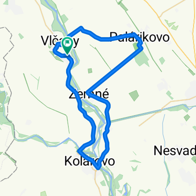
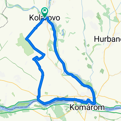
Road72
A cycling route starting in Kolárovo, Nitra Region, Slovakia.
Overview
About this route
- -:--
- Duration
- 72 km
- Distance
- 9 m
- Ascent
- 8 m
- Descent
- ---
- Avg. speed
- ---
- Max. altitude

Route quality
Waytypes & surfaces along the route
Waytypes
Road
28.1 km
(39 %)
Quiet road
4.3 km
(6 %)
Surfaces
Paved
49.7 km
(69 %)
Asphalt
49.7 km
(69 %)
Undefined
22.3 km
(31 %)
Route highlights
Points of interest along the route
Point of interest after 19.3 km
1. checkpoint
Point of interest after 44.8 km
2. checkpoint
Continue with Bikemap
Use, edit, or download this cycling route
You would like to ride Road72 or customize it for your own trip? Here is what you can do with this Bikemap route:
Free features
- Save this route as favorite or in collections
- Copy & plan your own version of this route
- Sync your route with Garmin or Wahoo
Premium features
Free trial for 3 days, or one-time payment. More about Bikemap Premium.
- Navigate this route on iOS & Android
- Export a GPX / KML file of this route
- Create your custom printout (try it for free)
- Download this route for offline navigation
Discover more Premium features.
Get Bikemap PremiumFrom our community
Other popular routes starting in Kolárovo
 14km Brigettio time trial training route
- Distance
- 14 km
- Ascent
- 41 m
- Descent
- 37 m
- Location
- Kolárovo, Nitra Region, Slovakia
 MTB45 2026
- Distance
- 43.4 km
- Ascent
- 56 m
- Descent
- 57 m
- Location
- Kolárovo, Nitra Region, Slovakia
 Kolárovo - Komarno - Zlatná - Kameničná - Kolárovo
- Distance
- 62.5 km
- Ascent
- 88 m
- Descent
- 89 m
- Location
- Kolárovo, Nitra Region, Slovakia
 TIP-TOP Túra MTB_45km
- Distance
- 3.8 km
- Ascent
- 0 m
- Descent
- 3 m
- Location
- Kolárovo, Nitra Region, Slovakia
 Kolárovo -Veľký Meder - Trstice - Vlčany - Kolárovo
- Distance
- 89.6 km
- Ascent
- 127 m
- Descent
- 128 m
- Location
- Kolárovo, Nitra Region, Slovakia
 Popri Malom Dunaji
- Distance
- 34.8 km
- Ascent
- 17 m
- Descent
- 20 m
- Location
- Kolárovo, Nitra Region, Slovakia
 Neded-Palarikovo-Kolarovo-Neded
- Distance
- 49.2 km
- Ascent
- 27 m
- Descent
- 27 m
- Location
- Kolárovo, Nitra Region, Slovakia
 Kolárovo Cycling
- Distance
- 64 km
- Ascent
- 29 m
- Descent
- 33 m
- Location
- Kolárovo, Nitra Region, Slovakia
Open it in the app