

Rednitz1
A cycling route starting in Fürth, Bavaria, Germany.
Overview
About this route
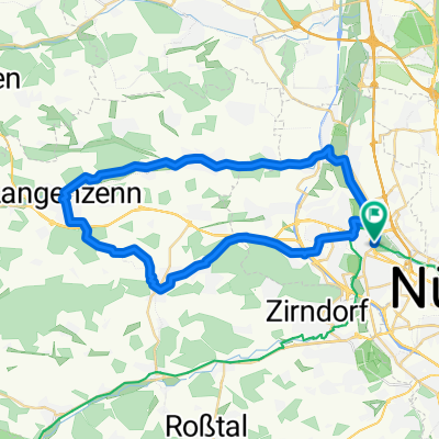
Fürth Stadtgrenze - Pegnitz Richtung Fürth - Rednitztal - Schweinau - Dianaplatz (Nbg)
- -:--
- Duration
- 21.4 km
- Distance
- 101 m
- Ascent
- 88 m
- Descent
- ---
- Avg. speed
- ---
- Max. altitude

Route quality
Waytypes & surfaces along the route
Waytypes
Path
8.5 km
(40 %)
Quiet road
4.8 km
(22 %)
Surfaces
Paved
17 km
(80 %)
Unpaved
1.9 km
(9 %)
Asphalt
14.9 km
(70 %)
Paving stones
1.5 km
(7 %)
Route highlights
Points of interest along the route
Point of interest after 15.2 km
Schloss Faber-Castell
Continue with Bikemap
Use, edit, or download this cycling route
You would like to ride Rednitz1 or customize it for your own trip? Here is what you can do with this Bikemap route:
Free features
- Save this route as favorite or in collections
- Copy & plan your own version of this route
- Sync your route with Garmin or Wahoo
Premium features
Free trial for 3 days, or one-time payment. More about Bikemap Premium.
- Navigate this route on iOS & Android
- Export a GPX / KML file of this route
- Create your custom printout (try it for free)
- Download this route for offline navigation
Discover more Premium features.
Get Bikemap PremiumFrom our community
Other popular routes starting in Fürth
 Fürth-Puschendorf-Obermichelbach
- Distance
- 76 km
- Ascent
- 429 m
- Descent
- 428 m
- Location
- Fürth, Bavaria, Germany
 Bremer Straße, Fürth nach Marktplatz, Neustadt an der Aisch
- Distance
- 37.2 km
- Ascent
- 319 m
- Descent
- 317 m
- Location
- Fürth, Bavaria, Germany
 Cadolzburg-Veitsbronn-Tour
- Distance
- 39.1 km
- Ascent
- 235 m
- Descent
- 235 m
- Location
- Fürth, Bavaria, Germany
 Thomas-Mann-Straße 10, Fürth nach Thomas-Mann-Straße 5, Fürth
- Distance
- 25 km
- Ascent
- 65 m
- Descent
- 69 m
- Location
- Fürth, Bavaria, Germany
 Auf der Burgenstraße von Fürth nach Langenzenn, Cadolzburg und zurück
- Distance
- 41.8 km
- Ascent
- 208 m
- Descent
- 210 m
- Location
- Fürth, Bavaria, Germany
 Bund Naturschutzgarten - Stadelner Wasserrad und zurück
- Distance
- 11.1 km
- Ascent
- 44 m
- Descent
- 42 m
- Location
- Fürth, Bavaria, Germany
 Hausrunde 60km
- Distance
- 57.8 km
- Ascent
- 568 m
- Descent
- 573 m
- Location
- Fürth, Bavaria, Germany
 Fürth-Nürnberg-Moritzberg-Fürth
- Distance
- 77.6 km
- Ascent
- 727 m
- Descent
- 714 m
- Location
- Fürth, Bavaria, Germany
Open it in the app