

Tour 2010 (3)
A cycling route starting in Le Puy-en-Velay, Auvergne-Rhône-Alpes, France.
Overview
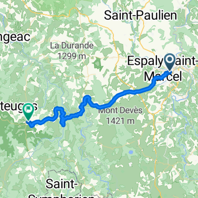
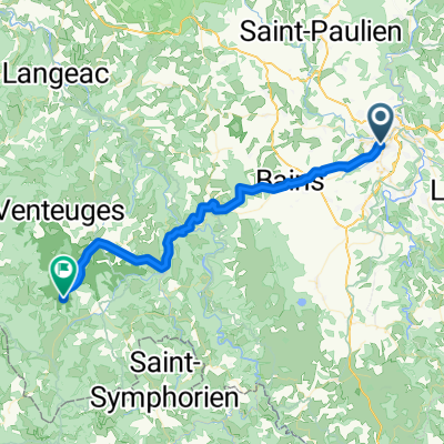
About this route
JH le-Puy-en-Velle - Saint-Bonnet-le-Chateau Camping
- -:--
- Duration
- 121.7 km
- Distance
- 1,856 m
- Ascent
- 1,600 m
- Descent
- ---
- Avg. speed
- 923 m
- Max. altitude
Route quality
Waytypes & surfaces along the route
Waytypes
Quiet road
13.4 km
(11 %)
Road
6.1 km
(5 %)
Surfaces
Paved
45 km
(37 %)
Unpaved
1.2 km
(1 %)
Asphalt
45 km
(37 %)
Ground
1.2 km
(1 %)
Undefined
75.4 km
(62 %)
Route highlights
Points of interest along the route
Point of interest after 0 km
Youthhostel Le-Puy-en-Velay Centre Pierre Cardinal 9 Rue Jules Vallès 43000 Le Puy en Velay (Haute Loire) France Tel. +33-471055240 Fax. +33-471056124 auberge.jeunesse@mairie-le-puy-en-velay.fr
Continue with Bikemap
Use, edit, or download this cycling route
You would like to ride Tour 2010 (3) or customize it for your own trip? Here is what you can do with this Bikemap route:
Free features
- Save this route as favorite or in collections
- Copy & plan your own version of this route
- Split it into stages to create a multi-day tour
- Sync your route with Garmin or Wahoo
Premium features
Free trial for 3 days, or one-time payment. More about Bikemap Premium.
- Navigate this route on iOS & Android
- Export a GPX / KML file of this route
- Create your custom printout (try it for free)
- Download this route for offline navigation
Discover more Premium features.
Get Bikemap PremiumFrom our community
Other popular routes starting in Le Puy-en-Velay
 Tour 2010 (3)
- Distance
- 121.7 km
- Ascent
- 1,856 m
- Descent
- 1,600 m
- Location
- Le Puy-en-Velay, Auvergne-Rhône-Alpes, France
 Day 1 - Way of St. James - Le Puy to SJPP
- Distance
- 42.9 km
- Ascent
- 972 m
- Descent
- 643 m
- Location
- Le Puy-en-Velay, Auvergne-Rhône-Alpes, France
 2019-18 Le-Puy-en-Velay - Circle to Queyrières
- Distance
- 52.6 km
- Ascent
- 682 m
- Descent
- 681 m
- Location
- Le Puy-en-Velay, Auvergne-Rhône-Alpes, France
 voie verte coubon
- Distance
- 18.1 km
- Ascent
- 155 m
- Descent
- 149 m
- Location
- Le Puy-en-Velay, Auvergne-Rhône-Alpes, France
 Jakobsweg Etappe 7 - Via Podensis : Le Puy - Decazeville
- Distance
- 226 km
- Ascent
- 2,507 m
- Descent
- 2,943 m
- Location
- Le Puy-en-Velay, Auvergne-Rhône-Alpes, France
 Le-Puy-en-Velay -> Thiers
- Distance
- 129.3 km
- Ascent
- 1,257 m
- Descent
- 1,497 m
- Location
- Le Puy-en-Velay, Auvergne-Rhône-Alpes, France
 Le Puy en Velay - Saint Jean Pied de Port
- Distance
- 715.6 km
- Ascent
- 2,295 m
- Descent
- 2,772 m
- Location
- Le Puy-en-Velay, Auvergne-Rhône-Alpes, France
 J1-Craponne-LePuy
- Distance
- 46.2 km
- Ascent
- 1,781 m
- Descent
- 1,319 m
- Location
- Le Puy-en-Velay, Auvergne-Rhône-Alpes, France
Open it in the app