

Most Kolejowy-Puszcza-2PL
A cycling route starting in Podłęże, Lesser Poland Voivodeship, Poland.
Overview
About this route
0
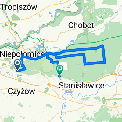
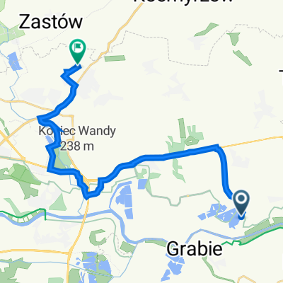
+2PL-Most kolejowy na Wiśle (ok. 15 km) - Niepołomice-Kłaj-Damienice-Baczków-Wieża-Czarny Staw-Niepołomice-Brzegi-2PL
- -:--
- Duration
- 65.2 km
- Distance
- 126 m
- Ascent
- 104 m
- Descent
- ---
- Avg. speed
- ---
- Max. altitude
Bogusław Baś
created this 8 years ago
Route quality
Waytypes & surfaces along the route
Waytypes
Road
26.7 km
41 %
Quiet road
20.2 km
31 %
Surfaces
Paved
47.6 km
(73 %)
Unpaved
7.8 km
(12 %)
Asphalt
44.3 km
68 %
Ground
3.9 km
6 %
Continue with Bikemap
Use, edit, or download this cycling route
You would like to ride Most Kolejowy-Puszcza-2PL or customize it for your own trip? Here is what you can do with this Bikemap route:
Free features
- Save this route as favorite or in collections
- Copy & plan your own version of this route
- Sync your route with Garmin or Wahoo
Premium features
Free trial for 3 days, or one-time payment. More about Bikemap Premium.
- Navigate this route on iOS & Android
- Export a GPX / KML file of this route
- Create your custom printout (try it for free)
- Download this route for offline navigation
Discover more Premium features.
Get Bikemap PremiumFrom our community
Other popular routes starting in Podłęże
- Zaporębie 31, Kraków to Aleja Jana Pawła II, Kraków0
- 14.7 km
- 39 m
- 74 m
- Podłęże, Lesser Poland Voivodeship, Poland
- Rzepakowa 16d, Kraków do Stary Gościniec 1I, Kraków0
- 18.5 km
- 82 m
- 73 m
- Podłęże, Lesser Poland Voivodeship, Poland
- Podłęże, Niepołomice do Kolejowa, Wieliczka0
- 31 km
- 479 m
- 478 m
- Podłęże, Lesser Poland Voivodeship, Poland


Open it in the app