Tag 1 - Etappe 3
A cycling route starting in Marxheim, Bavaria, Germany.
Overview
About this route
Characteristics:
- Some climbs and descents at the beginning, then the route becomes flat.
- Almost exclusively asphalt roads and paths.
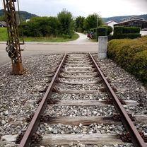
- The route passes through several small villages and Donauwörth. At the T-junction in Marxheim, turn left following the St2215 where you first tackle three small climbs followed by descents. After Altisheim, the route flattens out. Following St2215, ride through Zirgesheim and enter Donauwörth. Here, it is especially important to pay attention to the signage. In the old town, the cycle path passes a number of ice cream parlors and bakeries, where tired riders can take a short break if needed. Continuing over the Wörnitz bridges, the route heads south and passes under the railway line. Skirting the Airbus Helicopters facilities and passing under the B16, you'll reach the Donauwörth barrage, whose dam you cross (2nd crossing of the Danube), and for the next 10 kilometers you ride through mainly agricultural land characterized by numerous farms directly alongside the asphalt road. In Rettingen, take the cycle path left, continue along the road through Heidenau, and finally reach the T-junction at the DLG 23.
- -:--
- Duration
- 28.6 km
- Distance
- 162 m
- Ascent
- 162 m
- Descent
- ---
- Avg. speed
- ---
- Max. altitude
Route quality
Waytypes & surfaces along the route
Waytypes
Quiet road
9.2 km
(32 %)
Path
8.9 km
(31 %)
Surfaces
Paved
23.5 km
(82 %)
Unpaved
1.1 km
(4 %)
Asphalt
23.5 km
(82 %)
Gravel
1.1 km
(4 %)
Undefined
4 km
(14 %)
Route highlights
Points of interest along the route
Point of interest after 7.3 km
Durchlaufpunkt 5
Point of interest after 15.4 km
Kopplungspunkt für Mittagspause
Point of interest after 18.1 km
Durchlaufpunkt 6/Neuer SP nach Mittagspause
Point of interest after 28.6 km
Durchlaufpunkt 7
Continue with Bikemap
Use, edit, or download this cycling route
You would like to ride Tag 1 - Etappe 3 or customize it for your own trip? Here is what you can do with this Bikemap route:
Free features
- Save this route as favorite or in collections
- Copy & plan your own version of this route
- Sync your route with Garmin or Wahoo
Premium features
Free trial for 3 days, or one-time payment. More about Bikemap Premium.
- Navigate this route on iOS & Android
- Export a GPX / KML file of this route
- Create your custom printout (try it for free)
- Download this route for offline navigation
Discover more Premium features.
Get Bikemap PremiumFrom our community
Other popular routes starting in Marxheim
 Route nach St2047 7, Marxheim
- Distance
- 15 km
- Ascent
- 7 m
- Descent
- 7 m
- Location
- Marxheim, Bavaria, Germany
 Marxheim Cycling
- Distance
- 19.3 km
- Ascent
- 148 m
- Descent
- 214 m
- Location
- Marxheim, Bavaria, Germany
 Lechtalweg: Donaumündung zum Ursprung
- Distance
- 237.3 km
- Ascent
- 1,407 m
- Descent
- 87 m
- Location
- Marxheim, Bavaria, Germany
 Tag 1 - Etappe 3
- Distance
- 28.6 km
- Ascent
- 162 m
- Descent
- 162 m
- Location
- Marxheim, Bavaria, Germany
 Marxheim kurz
- Distance
- 125.2 km
- Ascent
- 2,029 m
- Descent
- 2,025 m
- Location
- Marxheim, Bavaria, Germany
 iller - Donautal 5.tag
- Distance
- 58.5 km
- Ascent
- 36 m
- Descent
- 77 m
- Location
- Marxheim, Bavaria, Germany
 2_Marxheim_Ingolstadt
- Distance
- 46 km
- Ascent
- 69 m
- Descent
- 106 m
- Location
- Marxheim, Bavaria, Germany
 Marxheim_Neuburg
- Distance
- 66.5 km
- Ascent
- 114 m
- Descent
- 114 m
- Location
- Marxheim, Bavaria, Germany
Open it in the app


