

🚴♀️E*Bike🇮🇩 Glurns-Meran-Bozen
A cycling route starting in Glurns, Trentino-Alto Adige, Italy.
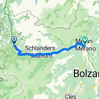
Overview
About this route
Hotel Poat Gries Freiheitsstraße, 117, 39100 Bozen, Italien Koordinaten 46.502575, 11.334797
Mpreis in Schlanders Koor. 46.628211, 10.772139
eishockeyspielfeld in meran 46.660387,11.156623
Mpreis Koordinaten 46.636492, 11.176140
- -:--
- Duration
- 90 km
- Distance
- 64 m
- Ascent
- 710 m
- Descent
- ---
- Avg. speed
- ---
- Max. altitude

Route photos


Route quality
Waytypes & surfaces along the route
Waytypes
Cycleway
41.2 km
(46 %)
Quiet road
19.8 km
(22 %)
Surfaces
Paved
80.9 km
(90 %)
Unpaved
5.3 km
(6 %)
Asphalt
80.6 km
(90 %)
Loose gravel
3.8 km
(4 %)
Route highlights
Points of interest along the route
Point of interest after 25.6 km
Mpreis in Schlanders Koor. 46.628211, 10.772139
Point of interest after 63.2 km
eishockeyspielfeld in meran 46.660387, 11.156623
Point of interest after 67.1 km
Mpreis Koordinaten 46.636492, 11.176140
Continue with Bikemap
Use, edit, or download this cycling route
You would like to ride 🚴♀️E*Bike🇮🇩 Glurns-Meran-Bozen or customize it for your own trip? Here is what you can do with this Bikemap route:
Free features
- Save this route as favorite or in collections
- Copy & plan your own version of this route
- Split it into stages to create a multi-day tour
- Sync your route with Garmin or Wahoo
Premium features
Free trial for 3 days, or one-time payment. More about Bikemap Premium.
- Navigate this route on iOS & Android
- Export a GPX / KML file of this route
- Create your custom printout (try it for free)
- Download this route for offline navigation
Discover more Premium features.
Get Bikemap PremiumFrom our community
Other popular routes starting in Glurns
 Dol Stilfser Joch
- Distance
- 62 km
- Ascent
- 1,836 m
- Descent
- 1,836 m
- Location
- Glurns, Trentino-Alto Adige, Italy
 🚴♀️E*Bike🇮🇩 MALS-GLURNS- MERAN
- Distance
- 61 km
- Ascent
- 62 m
- Descent
- 682 m
- Location
- Glurns, Trentino-Alto Adige, Italy
 Wiesenweg nach Glurns
- Distance
- 12.5 km
- Ascent
- 1,244 m
- Descent
- 172 m
- Location
- Glurns, Trentino-Alto Adige, Italy
 GDS - BDS: 05 Glurns - Nauders (15 Schlinigpass, Uina-Schlucht xxxxx)
- Distance
- 56.3 km
- Ascent
- 1,829 m
- Descent
- 1,386 m
- Location
- Glurns, Trentino-Alto Adige, Italy
 Glurns nach Melag (Südtirol)
- Distance
- 28.7 km
- Ascent
- 952 m
- Descent
- 47 m
- Location
- Glurns, Trentino-Alto Adige, Italy
 20140617_095125.gpx
- Distance
- 61.1 km
- Ascent
- 50 m
- Descent
- 659 m
- Location
- Glurns, Trentino-Alto Adige, Italy
 OrtlerRunde
- Distance
- 314.8 km
- Ascent
- 9,655 m
- Descent
- 9,655 m
- Location
- Glurns, Trentino-Alto Adige, Italy
 Stelvio - Gavia
- Distance
- 96.1 km
- Ascent
- 3,200 m
- Descent
- 2,862 m
- Location
- Glurns, Trentino-Alto Adige, Italy
Open it in the app