

Bikepacking po alpskih dolinah - Day 2
A cycling route starting in Mojstrana, Kranjska Gora, Slovenia.
Overview
About this route
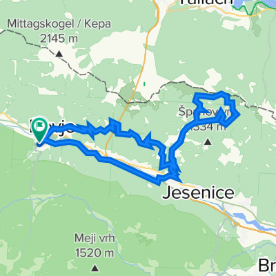
Radovna - Krma - Kot - Mojstrana - Dovje
- -:--
- Duration
- 29.2 km
- Distance
- 468 m
- Ascent
- 548 m
- Descent
- ---
- Avg. speed
- ---
- Max. altitude

Route quality
Waytypes & surfaces along the route
Waytypes
Track
15.9 km
(54 %)
Quiet road
7 km
(24 %)
Surfaces
Paved
8.7 km
(30 %)
Unpaved
20.3 km
(69 %)
Gravel
20.1 km
(69 %)
Asphalt
8.5 km
(29 %)
Continue with Bikemap
Use, edit, or download this cycling route
You would like to ride Bikepacking po alpskih dolinah - Day 2 or customize it for your own trip? Here is what you can do with this Bikemap route:
Free features
- Save this route as favorite or in collections
- Copy & plan your own version of this route
- Sync your route with Garmin or Wahoo
Premium features
Free trial for 3 days, or one-time payment. More about Bikemap Premium.
- Navigate this route on iOS & Android
- Export a GPX / KML file of this route
- Create your custom printout (try it for free)
- Download this route for offline navigation
Discover more Premium features.
Get Bikemap PremiumFrom our community
Other popular routes starting in Mojstrana
 STKP 06: Aljažev dom v Vratih – Poštarski dom na Vršiču
- Distance
- 37.3 km
- Ascent
- 1,038 m
- Descent
- 344 m
- Location
- Mojstrana, Kranjska Gora, Slovenia
 Mojstrana - Dolina Vrata - Mojstrana
- Distance
- 19.4 km
- Ascent
- 350 m
- Descent
- 340 m
- Location
- Mojstrana, Kranjska Gora, Slovenia
 Mojstrana, Golica
- Distance
- 43.8 km
- Ascent
- 1,435 m
- Descent
- 1,433 m
- Location
- Mojstrana, Kranjska Gora, Slovenia
 Mojstrana-Vršič-Log pod Mangartom-Mangartsko sedlo-Trbiž-Mojstrana
- Distance
- 133.8 km
- Ascent
- 2,746 m
- Descent
- 2,746 m
- Location
- Mojstrana, Kranjska Gora, Slovenia
 5. Etappe Dom Triglav - Triglav - Koca Prehadovicih
- Distance
- 11.3 km
- Ascent
- 667 m
- Descent
- 1,104 m
- Location
- Mojstrana, Kranjska Gora, Slovenia
 Da Belca a Jezerci 10
- Distance
- 16.3 km
- Ascent
- 215 m
- Descent
- 136 m
- Location
- Mojstrana, Kranjska Gora, Slovenia
 Triglavska cesta 90, Kranjska Gora to Triglavska cesta 47, Kranjska Gora
- Distance
- 10.4 km
- Ascent
- 88 m
- Descent
- 439 m
- Location
- Mojstrana, Kranjska Gora, Slovenia
 mojstrana bled
- Distance
- 51.9 km
- Ascent
- 575 m
- Descent
- 576 m
- Location
- Mojstrana, Kranjska Gora, Slovenia
Open it in the app