

Fuenfría y los Leones
A cycling route starting in Cercedilla, Madrid, Spain.
Overview
About this route
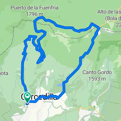
Mountain bike route starting from Cercedilla. It climbs to the Puerto de la Fuenfría and Collado Marichiva, from where it descends through Segovia province, passing through the Moros river basin, and returns to Madrid via the Alto del León.
- -:--
- Duration
- 36.3 km
- Distance
- 846 m
- Ascent
- 847 m
- Descent
- ---
- Avg. speed
- ---
- Max. altitude

Route quality
Waytypes & surfaces along the route
Waytypes
Track
25.8 km
(71 %)
Quiet road
4 km
(11 %)
Surfaces
Paved
6.2 km
(17 %)
Unpaved
27.2 km
(75 %)
Ground
17.1 km
(47 %)
Gravel
9.1 km
(25 %)
Continue with Bikemap
Use, edit, or download this cycling route
You would like to ride Fuenfría y los Leones or customize it for your own trip? Here is what you can do with this Bikemap route:
Free features
- Save this route as favorite or in collections
- Copy & plan your own version of this route
- Sync your route with Garmin or Wahoo
Premium features
Free trial for 3 days, or one-time payment. More about Bikemap Premium.
- Navigate this route on iOS & Android
- Export a GPX / KML file of this route
- Create your custom printout (try it for free)
- Download this route for offline navigation
Discover more Premium features.
Get Bikemap PremiumFrom our community
Other popular routes starting in Cercedilla
 Cercedilla - Cerca Barrancas - Embalse de la Venta - Ladera de las Berceas - Riscos de la Majadilla Verde - Campamentos - Cercedilla
- Distance
- 20.9 km
- Ascent
- 468 m
- Descent
- 471 m
- Location
- Cercedilla, Madrid, Spain
 Fuenfría y los Leones
- Distance
- 36.3 km
- Ascent
- 846 m
- Descent
- 847 m
- Location
- Cercedilla, Madrid, Spain
 Horizontal de la Fuenfria
- Distance
- 19.4 km
- Ascent
- 743 m
- Descent
- 264 m
- Location
- Cercedilla, Madrid, Spain
 CERCEDILLA-ABANTOS-EL ESCORIAL
- Distance
- 38 km
- Ascent
- 869 m
- Descent
- 1,125 m
- Location
- Cercedilla, Madrid, Spain
 Los Tres Valles
- Distance
- 48.8 km
- Ascent
- 1,225 m
- Descent
- 1,225 m
- Location
- Cercedilla, Madrid, Spain
 Cercedilla- Pto.Fuenfría- Pto. Navacerrada- Alto Guarramillas (Bola del mundo)
- Distance
- 21.1 km
- Ascent
- 1,305 m
- Descent
- 236 m
- Location
- Cercedilla, Madrid, Spain
 cercedilla - mirador del poeta - cercedilla
- Distance
- 18.4 km
- Ascent
- 612 m
- Descent
- 610 m
- Location
- Cercedilla, Madrid, Spain
 Cercedilla - Pto. Fuenfría - Pto. Navacerrada - Cercedilla
- Distance
- 28.9 km
- Ascent
- 800 m
- Descent
- 801 m
- Location
- Cercedilla, Madrid, Spain
Open it in the app