

🚴♀️E*Bike🇦🇹 3.Tag Illerradweg vom Ursrung-Kempten 27.06.18.
A cycling route starting in Oberstdorf, Bavaria, Germany.
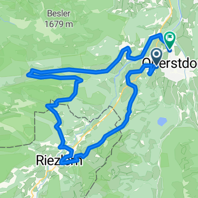
Overview
About this route
KEMPTEN Eichenstraße zurück bis zum Bahnhof (hintere Seite), siehe Plan - 47.709040, 10.318466
Krugzell an der Iller bei der Brücke oder im Gewerbegebiet laut Plan-n 47.797077, 10.271883 Kraftwerk oder - 47.798744, 10.266979 Gewerbestraße oder - 47.792294, 10.257744 Bundesstraße
Adil und Immenstadt bei km 20
Norma in Kempten bei km 46
- -:--
- Duration
- 61.8 km
- Distance
- 75 m
- Ascent
- 232 m
- Descent
- ---
- Avg. speed
- ---
- Max. altitude

Route photos


Route quality
Waytypes & surfaces along the route
Waytypes
Path
23.4 km
(38 %)
Cycleway
14.7 km
(24 %)
Surfaces
Paved
17.7 km
(29 %)
Unpaved
40.4 km
(65 %)
Gravel
37.7 km
(61 %)
Asphalt
16.3 km
(26 %)
Route highlights
Points of interest along the route
Point of interest after 19.9 km
Adil und Immenstadt bei km 20
Point of interest after 43.9 km
Kempten Eichenstraße zurück bis zum Bahnhof (hintere Seite), siehe Plan 47.709040, 10.318466
Point of interest after 46.4 km
Norma in Kempten bei km 46
Point of interest after 59.9 km
47.797077, 10.271883 Kraftwerk
Point of interest after 60.4 km
oder - 47.798744, 10.266979
Continue with Bikemap
Use, edit, or download this cycling route
You would like to ride 🚴♀️E*Bike🇦🇹 3.Tag Illerradweg vom Ursrung-Kempten 27.06.18. or customize it for your own trip? Here is what you can do with this Bikemap route:
Free features
- Save this route as favorite or in collections
- Copy & plan your own version of this route
- Sync your route with Garmin or Wahoo
Premium features
Free trial for 3 days, or one-time payment. More about Bikemap Premium.
- Navigate this route on iOS & Android
- Export a GPX / KML file of this route
- Create your custom printout (try it for free)
- Download this route for offline navigation
Discover more Premium features.
Get Bikemap PremiumFrom our community
Other popular routes starting in Oberstdorf
 Transalp Etappe 1: Oberstdorf - Dalaas
- Distance
- 55.4 km
- Ascent
- 1,503 m
- Descent
- 1,458 m
- Location
- Oberstdorf, Bavaria, Germany
 1) Stillacherstr. - Trettachtal + zurück
- Distance
- 19.9 km
- Ascent
- 241 m
- Descent
- 268 m
- Location
- Oberstdorf, Bavaria, Germany
 7) Radtour Kleinwalsertal
- Distance
- 34.1 km
- Ascent
- 899 m
- Descent
- 902 m
- Location
- Oberstdorf, Bavaria, Germany
 Oberstdorf Marathon 2015 Mittelstrecke
- Distance
- 32.2 km
- Ascent
- 733 m
- Descent
- 735 m
- Location
- Oberstdorf, Bavaria, Germany
 MTB Oberstdorf - DAY_5 (6_2009) - Kanzelwand
- Distance
- 43.4 km
- Ascent
- 1,377 m
- Descent
- 1,377 m
- Location
- Oberstdorf, Bavaria, Germany
 Breitach Kleinwalsertal
- Distance
- 33.9 km
- Ascent
- 715 m
- Descent
- 709 m
- Location
- Oberstdorf, Bavaria, Germany
 Oberstdorf - Käseralpe
- Distance
- 22.8 km
- Ascent
- 631 m
- Descent
- 630 m
- Location
- Oberstdorf, Bavaria, Germany
 Illerradweg
- Distance
- 145.8 km
- Ascent
- 342 m
- Descent
- 676 m
- Location
- Oberstdorf, Bavaria, Germany
Open it in the app