

Oberpfälzisch-Fränkische Jakobsweg
A cycling route starting in Schwandorf in Bayern, Bavaria, Germany.
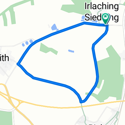
Overview
About this route
The Way of St. James is the path of knowledge, a way to oneself. Nowadays, more and more people are searching for a way to escape from the hectic everyday life. Slowing down, finding peace, recharging - that is especially possible while piligriming. The Oberpfalz-Franconian Way of St. James extends over a total of 170 kilometers in about ten to fifteen stages from Tillyschanz (CZ) to Nuremberg.
Perhaps the most beautiful section of the Oberpfalz-Franconian Way of St. James is the route from Schwandorf in Oberpfalz to Nuremberg, the largest city in Franconia. Over 123 kilometers, you walk here in six stages through the Oberpfalz Forest, the Bavarian Jura, and the Nuremberg region. The pilgrimage journey through nature, past monasteries, churches, and castles provides a good impression of the significance that pilgrimage had for people in the Middle Ages.
- -:--
- Duration
- 123.1 km
- Distance
- 745 m
- Ascent
- 801 m
- Descent
- ---
- Avg. speed
- ---
- Max. altitude
Route quality
Waytypes & surfaces along the route
Waytypes
Track
61.6 km
(50 %)
Quiet road
27.1 km
(22 %)
Surfaces
Paved
44.3 km
(36 %)
Unpaved
62.8 km
(51 %)
Asphalt
40.6 km
(33 %)
Gravel
35.7 km
(29 %)
Continue with Bikemap
Use, edit, or download this cycling route
You would like to ride Oberpfälzisch-Fränkische Jakobsweg or customize it for your own trip? Here is what you can do with this Bikemap route:
Free features
- Save this route as favorite or in collections
- Copy & plan your own version of this route
- Split it into stages to create a multi-day tour
- Sync your route with Garmin or Wahoo
Premium features
Free trial for 3 days, or one-time payment. More about Bikemap Premium.
- Navigate this route on iOS & Android
- Export a GPX / KML file of this route
- Create your custom printout (try it for free)
- Download this route for offline navigation
Discover more Premium features.
Get Bikemap PremiumFrom our community
Other popular routes starting in Schwandorf in Bayern
 B2-4/Saale 4a kurz: Ettmannsdorf-West - Weiden, Am Tor, 57,4km, 170hm
- Distance
- 57.4 km
- Ascent
- 256 m
- Descent
- 240 m
- Location
- Schwandorf in Bayern, Bavaria, Germany
 Rund um Naabeck
- Distance
- 18.7 km
- Ascent
- 159 m
- Descent
- 159 m
- Location
- Schwandorf in Bayern, Bavaria, Germany
 Einfürungstour / Sa 30.06.2012
- Distance
- 31.9 km
- Ascent
- 230 m
- Descent
- 230 m
- Location
- Schwandorf in Bayern, Bavaria, Germany
 Richter Berg Ka1, 1,5km, 45HM
- Distance
- 3.8 km
- Ascent
- 58 m
- Descent
- 55 m
- Location
- Schwandorf in Bayern, Bavaria, Germany
 Oberpfälzisch-Fränkische Jakobsweg
- Distance
- 123.1 km
- Ascent
- 745 m
- Descent
- 801 m
- Location
- Schwandorf in Bayern, Bavaria, Germany
 Drei-Schlösser-Runde
- Distance
- 55.7 km
- Ascent
- 398 m
- Descent
- 398 m
- Location
- Schwandorf in Bayern, Bavaria, Germany
 Von Schwandorf bis Teublitz
- Distance
- 11.6 km
- Ascent
- 104 m
- Descent
- 106 m
- Location
- Schwandorf in Bayern, Bavaria, Germany
 Angerring 35, Schwandorf nach Angerring 34, Schwandorf
- Distance
- 17.4 km
- Ascent
- 199 m
- Descent
- 198 m
- Location
- Schwandorf in Bayern, Bavaria, Germany
Open it in the app