

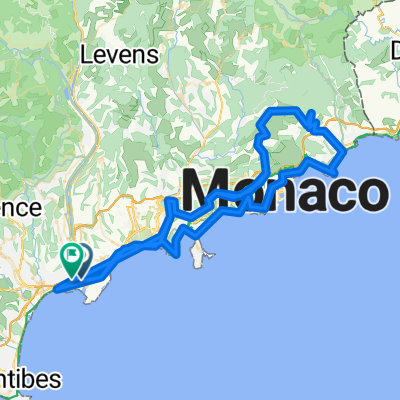
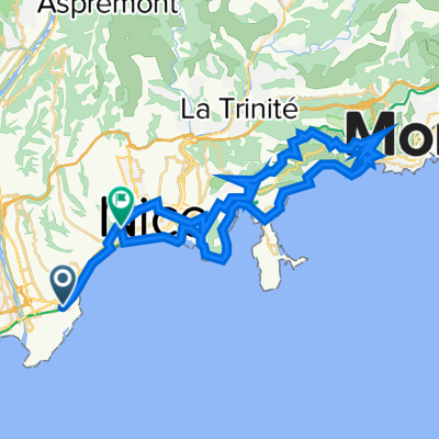
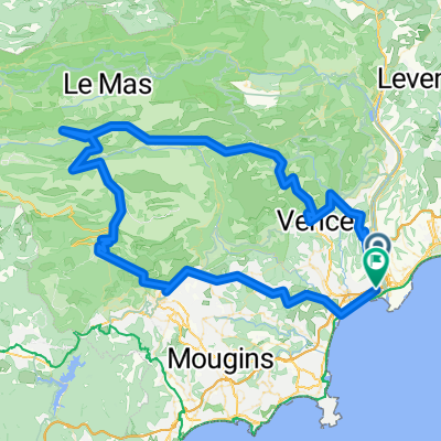
E1-ColTurini
A cycling route starting in Saint-Laurent-du-Var, Provence-Alpes-Côte d'Azur Region, France.
Overview
About this route
- -:--
- Duration
- 56.6 km
- Distance
- 1,702 m
- Ascent
- 99 m
- Descent
- ---
- Avg. speed
- ---
- Max. altitude

Route highlights
Points of interest along the route
Drinking water after 7.1 km
Supermarkt
Drinking water after 30.1 km
Supermarkt
Point of interest after 36 km
Luceram
Continue with Bikemap
Use, edit, or download this cycling route
You would like to ride E1-ColTurini or customize it for your own trip? Here is what you can do with this Bikemap route:
Free features
- Save this route as favorite or in collections
- Copy & plan your own version of this route
- Sync your route with Garmin or Wahoo
Premium features
Free trial for 3 days, or one-time payment. More about Bikemap Premium.
- Navigate this route on iOS & Android
- Export a GPX / KML file of this route
- Create your custom printout (try it for free)
- Download this route for offline navigation
Discover more Premium features.
Get Bikemap PremiumFrom our community
Other popular routes starting in Saint-Laurent-du-Var
 FRANCIA_????_patrikfroment
- Distance
- 197.6 km
- Ascent
- 3,039 m
- Descent
- 3,022 m
- Location
- Saint-Laurent-du-Var, Provence-Alpes-Côte d'Azur Region, France
 Nizza-Manosque
- Distance
- 186 km
- Ascent
- 1,316 m
- Descent
- 997 m
- Location
- Saint-Laurent-du-Var, Provence-Alpes-Côte d'Azur Region, France
 Tour France_ Nice - Nice ITT
- Distance
- 43.8 km
- Ascent
- 657 m
- Descent
- 634 m
- Location
- Saint-Laurent-du-Var, Provence-Alpes-Côte d'Azur Region, France
 De 18 Avenue du Docteur Émile Roux, Nice à 1 Calada Auguste Escoffier, Nice
- Distance
- 13.6 km
- Ascent
- 0 m
- Descent
- 10 m
- Location
- Saint-Laurent-du-Var, Provence-Alpes-Côte d'Azur Region, France
 Itinéraire vers 1–3 Rue André Cane, Beaulieu-sur-Mer
- Distance
- 17.2 km
- Ascent
- 6 m
- Descent
- 15 m
- Location
- Saint-Laurent-du-Var, Provence-Alpes-Côte d'Azur Region, France
 FRANCIA_124_2101_Sortie longue ride 🚲 st laurent du var, moyenne corniche les pugets, vence , col de vence, greolieres, thorenc village, col de castellaras...
- Distance
- 123.2 km
- Ascent
- 2,033 m
- Descent
- 2,027 m
- Location
- Saint-Laurent-du-Var, Provence-Alpes-Côte d'Azur Region, France
 Frankreich 845 km
- Distance
- 844 km
- Ascent
- 7,485 m
- Descent
- 7,364 m
- Location
- Saint-Laurent-du-Var, Provence-Alpes-Côte d'Azur Region, France
 FRANCIA_141_2895
- Distance
- 138.2 km
- Ascent
- 2,823 m
- Descent
- 2,825 m
- Location
- Saint-Laurent-du-Var, Provence-Alpes-Côte d'Azur Region, France
Open it in the app