

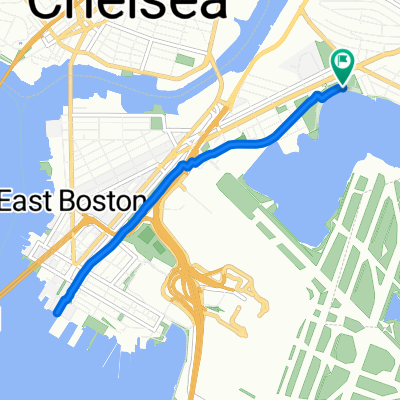
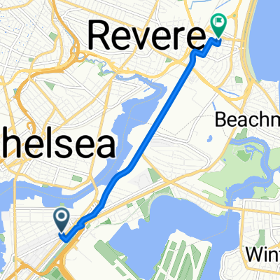
airport sta - deer island
A cycling route starting in Chelsea, Massachusetts, United States.
Overview
About this route
- 40 min
- Duration
- 11.5 km
- Distance
- 569 m
- Ascent
- 569 m
- Descent
- 17.2 km/h
- Avg. speed
- ---
- Max. altitude

Route photos

Continue with Bikemap
Use, edit, or download this cycling route
You would like to ride airport sta - deer island or customize it for your own trip? Here is what you can do with this Bikemap route:
Free features
- Save this route as favorite or in collections
- Copy & plan your own version of this route
- Sync your route with Garmin or Wahoo
Premium features
Free trial for 3 days, or one-time payment. More about Bikemap Premium.
- Navigate this route on iOS & Android
- Export a GPX / KML file of this route
- Create your custom printout (try it for free)
- Download this route for offline navigation
Discover more Premium features.
Get Bikemap PremiumFrom our community
Other popular routes starting in Chelsea
 US1 Boston - Ellisville
- Distance
- 96.6 km
- Ascent
- 314 m
- Descent
- 314 m
- Location
- Chelsea, Massachusetts, United States
 Bike Week Day 4: East Boston Greenway
- Distance
- 7.3 km
- Ascent
- 24 m
- Descent
- 23 m
- Location
- Chelsea, Massachusetts, United States
 Washington Avenue 422, Chelsea to Hall Street 174, Dunstable
- Distance
- 55.9 km
- Ascent
- 712 m
- Descent
- 666 m
- Location
- Chelsea, Massachusetts, United States
 Recovered Route
- Distance
- 38.9 km
- Ascent
- 0 m
- Descent
- 6 m
- Location
- Chelsea, Massachusetts, United States
 airport sta - deer island
- Distance
- 11.5 km
- Ascent
- 569 m
- Descent
- 569 m
- Location
- Chelsea, Massachusetts, United States
 7/26 Boston to Brookfield MA
- Distance
- 117.8 km
- Ascent
- 1,312 m
- Descent
- 1,088 m
- Location
- Chelsea, Massachusetts, United States
 Quick Ride
- Distance
- 5 km
- Ascent
- 20 m
- Descent
- 22 m
- Location
- Chelsea, Massachusetts, United States
 kayla’s house vibes 👻⭐️
- Distance
- 4.8 km
- Ascent
- 42 m
- Descent
- 34 m
- Location
- Chelsea, Massachusetts, United States
Open it in the app