

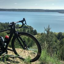
zur schönen Hummel ;-)
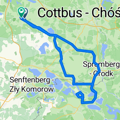
A cycling route starting in Kalawa, Brandenburg, Germany.
Overview
About this route
- 48 min
- Duration
- 30.2 km
- Distance
- 367 m
- Ascent
- 386 m
- Descent
- 38 km/h
- Avg. speed
- ---
- Max. altitude
Route quality
Waytypes & surfaces along the route
Waytypes
Path
6.3 km
(21 %)
Road
0.6 km
(2 %)
Surfaces
Paved
23.9 km
(79 %)
Asphalt
23.9 km
(79 %)
Undefined
6.3 km
(21 %)
Continue with Bikemap
Use, edit, or download this cycling route
You would like to ride zur schönen Hummel ;-) or customize it for your own trip? Here is what you can do with this Bikemap route:
Free features
- Save this route as favorite or in collections
- Copy & plan your own version of this route
- Sync your route with Garmin or Wahoo
Premium features
Free trial for 3 days, or one-time payment. More about Bikemap Premium.
- Navigate this route on iOS & Android
- Export a GPX / KML file of this route
- Create your custom printout (try it for free)
- Download this route for offline navigation
Discover more Premium features.
Get Bikemap PremiumFrom our community
Other popular routes starting in Kalawa
 Himmelfahrt
- Distance
- 74.5 km
- Ascent
- 826 m
- Descent
- 837 m
- Location
- Kalawa, Brandenburg, Germany
 Säritz, Ortsmitte, Calau nach Neue Gartenstraße 4, Luckau
- Distance
- 10.2 km
- Ascent
- 70 m
- Descent
- 87 m
- Location
- Kalawa, Brandenburg, Germany
 RTF - Calau (ungefähr ;) )
- Distance
- 78.4 km
- Ascent
- 289 m
- Descent
- 291 m
- Location
- Kalawa, Brandenburg, Germany
 Runde zur F60
- Distance
- 93 km
- Ascent
- 187 m
- Descent
- 184 m
- Location
- Kalawa, Brandenburg, Germany
 Single Tour 1.5.2020
- Distance
- 59 km
- Ascent
- 186 m
- Descent
- 186 m
- Location
- Kalawa, Brandenburg, Germany
 Runde zur 'Ranch' bei Hoyerswerda
- Distance
- 162.3 km
- Ascent
- 283 m
- Descent
- 270 m
- Location
- Kalawa, Brandenburg, Germany
 RTF Calauer Schweiz 2012
- Distance
- 142.2 km
- Ascent
- 408 m
- Descent
- 408 m
- Location
- Kalawa, Brandenburg, Germany
 RTF 120 km Rund um die Calauer Schweiz 2017
- Distance
- 115.3 km
- Ascent
- 348 m
- Descent
- 349 m
- Location
- Kalawa, Brandenburg, Germany
Open it in the app