

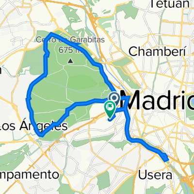
River and gardens route
A cycling route starting in Madrid, Madrid, Spain.
Overview
About this route
- -:--
- Duration
- 13.3 km
- Distance
- 99 m
- Ascent
- 94 m
- Descent
- ---
- Avg. speed
- ---
- Max. altitude

Continue with Bikemap
Use, edit, or download this cycling route
You would like to ride River and gardens route or customize it for your own trip? Here is what you can do with this Bikemap route:
Free features
- Save this route as favorite or in collections
- Copy & plan your own version of this route
- Sync your route with Garmin or Wahoo
Premium features
Free trial for 3 days, or one-time payment. More about Bikemap Premium.
- Navigate this route on iOS & Android
- Export a GPX / KML file of this route
- Create your custom printout (try it for free)
- Download this route for offline navigation
Discover more Premium features.
Get Bikemap PremiumFrom our community
Other popular routes starting in Madrid
 River and gardens route
- Distance
- 13.3 km
- Ascent
- 99 m
- Descent
- 94 m
- Location
- Madrid, Madrid, Spain
 De Calle de Caramuel 17, Madrid a Calle Hermanos Pinzón 5, San Martín de la Vega
- Distance
- 30 km
- Ascent
- 294 m
- Descent
- 374 m
- Location
- Madrid, Madrid, Spain
 Super spaind
- Distance
- 20.5 km
- Ascent
- 158 m
- Descent
- 164 m
- Location
- Madrid, Madrid, Spain
 Vuelta a la Casa de Campo
- Distance
- 19.8 km
- Ascent
- 169 m
- Descent
- 165 m
- Location
- Madrid, Madrid, Spain
 Calle de Cobos de Segovia, Madrid a Paseo Melancolicos, Madrid
- Distance
- 22.5 km
- Ascent
- 69 m
- Descent
- 67 m
- Location
- Madrid, Madrid, Spain
 Paseo de Extremadura, 41–53, Madrid a Calle de Pericles, 28, Madrid
- Distance
- 25.7 km
- Ascent
- 647 m
- Descent
- 640 m
- Location
- Madrid, Madrid, Spain
 puerta del sol-brunete
- Distance
- 11 km
- Ascent
- 130 m
- Descent
- 95 m
- Location
- Madrid, Madrid, Spain
 Casa de Campo-Guadalix de la Sierra-Torrelaguna-Torrejon del Rey-Alcala de Henares
- Distance
- 123.4 km
- Ascent
- 682 m
- Descent
- 688 m
- Location
- Madrid, Madrid, Spain
Open it in the app