

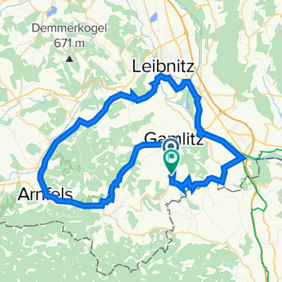
Gamlitz 3
A cycling route starting in Sulztal an der Weinstraße, Styria, Austria.
Overview
About this route
- -:--
- Duration
- 33 km
- Distance
- 747 m
- Ascent
- 749 m
- Descent
- ---
- Avg. speed
- ---
- Max. altitude
Route quality
Waytypes & surfaces along the route
Waytypes
Quiet road
20.8 km
(63 %)
Road
1.7 km
(5 %)
Undefined
10.6 km
(32 %)
Surfaces
Paved
9.6 km
(29 %)
Asphalt
9.6 km
(29 %)
Undefined
23.5 km
(71 %)
Continue with Bikemap
Use, edit, or download this cycling route
You would like to ride Gamlitz 3 or customize it for your own trip? Here is what you can do with this Bikemap route:
Free features
- Save this route as favorite or in collections
- Copy & plan your own version of this route
- Sync your route with Garmin or Wahoo
Premium features
Free trial for 3 days, or one-time payment. More about Bikemap Premium.
- Navigate this route on iOS & Android
- Export a GPX / KML file of this route
- Create your custom printout (try it for free)
- Download this route for offline navigation
Discover more Premium features.
Get Bikemap PremiumFrom our community
Other popular routes starting in Sulztal an der Weinstraße
 Eckberg 38 to Eckberg 35
- Distance
- 65 km
- Ascent
- 1,238 m
- Descent
- 1,215 m
- Location
- Sulztal an der Weinstraße, Styria, Austria
 Kulinarische Weinbergwanderung– Tour 15 lt. WK „Von der Alm zum Wein“
- Distance
- 6.2 km
- Ascent
- 320 m
- Descent
- 321 m
- Location
- Sulztal an der Weinstraße, Styria, Austria
 5 A. Südsteirische Weinstraße-Leibnitztraße nach Leibnitz
- Distance
- 44.1 km
- Ascent
- 507 m
- Descent
- 667 m
- Location
- Sulztal an der Weinstraße, Styria, Austria
 Südsteiermark
- Distance
- 17.3 km
- Ascent
- 276 m
- Descent
- 370 m
- Location
- Sulztal an der Weinstraße, Styria, Austria
 Panoramaweg
- Distance
- 50 km
- Ascent
- 1,145 m
- Descent
- 1,145 m
- Location
- Sulztal an der Weinstraße, Styria, Austria
 5 B. Südsteirische Weinstraße-Leibnitztraße nach Leibnitz
- Distance
- 41.2 km
- Ascent
- 487 m
- Descent
- 643 m
- Location
- Sulztal an der Weinstraße, Styria, Austria
 Steiermark 7. Etappe
- Distance
- 81.1 km
- Ascent
- 184 m
- Descent
- 284 m
- Location
- Sulztal an der Weinstraße, Styria, Austria
 Marco - Drau - Pesnica und retour
- Distance
- 68.8 km
- Ascent
- 728 m
- Descent
- 732 m
- Location
- Sulztal an der Weinstraße, Styria, Austria
Open it in the app