
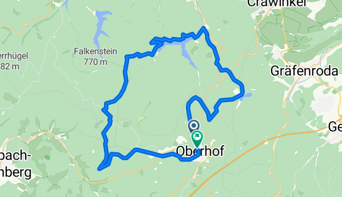
MTB-Oberhof-34km-Runde
A cycling route starting in Oberhof, Thuringia, Germany.
Overview
About this route
- -:--
- Duration
- 33.6 km
- Distance
- 749 m
- Ascent
- 732 m
- Descent
- ---
- Avg. speed
- ---
- Max. altitude
Route quality
Waytypes & surfaces along the route
Waytypes
Track
29.9 km
(89 %)
Quiet road
1.3 km
(4 %)
Surfaces
Paved
7.4 km
(22 %)
Unpaved
25.5 km
(76 %)
Gravel
16.8 km
(50 %)
Loose gravel
6 km
(18 %)
Continue with Bikemap
Use, edit, or download this cycling route
You would like to ride MTB-Oberhof-34km-Runde or customize it for your own trip? Here is what you can do with this Bikemap route:
Free features
- Save this route as favorite or in collections
- Copy & plan your own version of this route
- Sync your route with Garmin or Wahoo
Premium features
Free trial for 3 days, or one-time payment. More about Bikemap Premium.
- Navigate this route on iOS & Android
- Export a GPX / KML file of this route
- Create your custom printout (try it for free)
- Download this route for offline navigation
Discover more Premium features.
Get Bikemap PremiumFrom our community
Other popular routes starting in Oberhof
 Talsperrenrunde
- Distance
- 30.8 km
- Ascent
- 563 m
- Descent
- 563 m
- Location
- Oberhof, Thuringia, Germany
 Langlaufrunde um den Schneekopf
- Distance
- 16.8 km
- Ascent
- 379 m
- Descent
- 379 m
- Location
- Oberhof, Thuringia, Germany
 Oberhof nach Fladungen Christian
- Distance
- 89.3 km
- Ascent
- 729 m
- Descent
- 1,102 m
- Location
- Oberhof, Thuringia, Germany
 Oberhof Ohratalsperre
- Distance
- 30.9 km
- Ascent
- 637 m
- Descent
- 603 m
- Location
- Oberhof, Thuringia, Germany
 Rundtour über Brotterode
- Distance
- 89.9 km
- Ascent
- 1,022 m
- Descent
- 1,271 m
- Location
- Oberhof, Thuringia, Germany
 Rundtour Oberhof Talsperre Ratscher
- Distance
- 107.3 km
- Ascent
- 1,306 m
- Descent
- 1,481 m
- Location
- Oberhof, Thuringia, Germany
 2013-Sonntag-nachmittag
- Distance
- 112.7 km
- Ascent
- 291 m
- Descent
- 929 m
- Location
- Oberhof, Thuringia, Germany
 Oberhoftour 3. Tag
- Distance
- 35.5 km
- Ascent
- 511 m
- Descent
- 486 m
- Location
- Oberhof, Thuringia, Germany
Open it in the app