

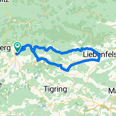
RR-Berg: HA-FE-St.Martin-Glanegg-Liebenfels-Limberg-St.Urban-Rogg-HA
A cycling route starting in Feldkirchen in Kärnten, Carinthia, Austria.
Overview
About this route
RR-Berg: HA-FE-St.Martin-Glanegg-Liebenfels-Limberg-St.Urban-Rogg-HA
- -:--
- Duration
- 37.7 km
- Distance
- 414 m
- Ascent
- 415 m
- Descent
- ---
- Avg. speed
- ---
- Max. altitude

Route quality
Waytypes & surfaces along the route
Waytypes
Busy road
26.6 km
(71 %)
Quiet road
8.2 km
(22 %)
Surfaces
Paved
16.6 km
(44 %)
Asphalt
16.6 km
(44 %)
Undefined
21.1 km
(56 %)
Continue with Bikemap
Use, edit, or download this cycling route
You would like to ride RR-Berg: HA-FE-St.Martin-Glanegg-Liebenfels-Limberg-St.Urban-Rogg-HA or customize it for your own trip? Here is what you can do with this Bikemap route:
Free features
- Save this route as favorite or in collections
- Copy & plan your own version of this route
- Sync your route with Garmin or Wahoo
Premium features
Free trial for 3 days, or one-time payment. More about Bikemap Premium.
- Navigate this route on iOS & Android
- Export a GPX / KML file of this route
- Create your custom printout (try it for free)
- Download this route for offline navigation
Discover more Premium features.
Get Bikemap PremiumFrom our community
Other popular routes starting in Feldkirchen in Kärnten
 Feldkirchen - Himmelberg - Wachsenberg - Goggausee - Feldkirchen
- Distance
- 38.5 km
- Ascent
- 608 m
- Descent
- 607 m
- Location
- Feldkirchen in Kärnten, Carinthia, Austria
 Sonnenuntergangsrunde
- Distance
- 20.4 km
- Ascent
- 175 m
- Descent
- 178 m
- Location
- Feldkirchen in Kärnten, Carinthia, Austria
 GRV-Berg: HA-St.Ulrich-Rogg-St.Martin-GlantalRadweg-Glanegg-Liebenfels-Limberg-St.Urban-Rogg-HA
- Distance
- 38.9 km
- Ascent
- 662 m
- Descent
- 661 m
- Location
- Feldkirchen in Kärnten, Carinthia, Austria
 Feldkirchen - Ulrichsberg - St. Veit/Glan - Sörg - St. Urban - Feldkirchen
- Distance
- 78 km
- Ascent
- 1,693 m
- Descent
- 1,678 m
- Location
- Feldkirchen in Kärnten, Carinthia, Austria
 RR-Berg: HA-FE-St.Martin-Glanegg-Liebenfels-Limberg-St.Urban-Rogg-HA
- Distance
- 37.7 km
- Ascent
- 414 m
- Descent
- 415 m
- Location
- Feldkirchen in Kärnten, Carinthia, Austria
 GRV-Flach: HA-FE-Ossiach-Treffen-Krastal-Drautal-Lendorf
- Distance
- 72.3 km
- Ascent
- 686 m
- Descent
- 713 m
- Location
- Feldkirchen in Kärnten, Carinthia, Austria
 Feldkirchen - Markstein - Sittich - Briefelsdorf - Hart - St.Martin - Förolach - St.Ruprecht - Feld
- Distance
- 21 km
- Ascent
- 415 m
- Descent
- 365 m
- Location
- Feldkirchen in Kärnten, Carinthia, Austria
 MTB-Flach: FE - Villach
- Distance
- 27.6 km
- Ascent
- 154 m
- Descent
- 202 m
- Location
- Feldkirchen in Kärnten, Carinthia, Austria
Open it in the app