
SLA: Entlang der gesamten Schwarzen Laber
A cycling route starting in Pilsach, Bavaria, Germany.
Overview
About this route
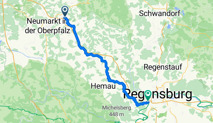
The Schwarze Laber is a left tributary of the Danube in the Upper Palatinate, approximately 78 km long. It is my 'home river', especially in the area between Parsberg and Beratzhausen - this is where I feel at home :-)
The route through the picturesque Upper Palatinate Jura runs from the source of the Laber (in Laaber near Pilsach) to its confluence with the Danube at Sinzing, passing through the districts of Neumarkt and Regensburg.
The Labertal Cycling Path is now largely well developed and signposted. It uses almost exclusively bike paths or combined cycling and walking paths as well as side roads, most of which run very close to the river. The majority of the route is paved, about a quarter follows decent gravel roads, which are easily passable with touring or trekking bikes. The route is not suitable for racing bikes.
Despite the generally solid development and signage, the route is far from being a 'cycle freeway'. In character, it is more of a leisurely cycling trail, and from Klapfenberg onward you frequently encounter many walkers.
By the way, there are different data regarding the exact length of the Schwarze Laber: the information board at the source states 78 km, wikipedia.de mentions 67 km, in contrast to wikipedia.com which says 76 km, and the 'Experience Guide' of the districts of Regensburg and Neumarkt states 'just under 80 km'. What is certain is that the cycling route described here along the river is 72 km ;-)
- -:--
- Duration
- 71.7 km
- Distance
- 165 m
- Ascent
- 353 m
- Descent
- ---
- Avg. speed
- ---
- Max. altitude

Route photos


Route quality
Waytypes & surfaces along the route
Waytypes
Quiet road
22.9 km
(32 %)
Track
15 km
(21 %)
Surfaces
Paved
39.4 km
(55 %)
Unpaved
21.5 km
(30 %)
Asphalt
37.3 km
(52 %)
Gravel
15.8 km
(22 %)
Route highlights
Points of interest along the route

Photo after 0.7 km
Laaber, Gemeinde Pilsach: Hier geht's los

Photo after 7.9 km
Ausblick über Deusmauer Moor

Photo after 39.6 km
Eisenbahnbrücke bei Beratzhausen (die dritthöchste Eisenbahnbrücke in Bayern)

Photo after 43.6 km
Kleine Radler- und Fußgängerbrücke nach der Gleislmühle

Photo after 58 km
Blick auf die Burgruine Loch

Photo after 60.5 km
Bei Schönhofen, rechts die stets gut belegten Kletterfelsen

Photo after 63.1 km
Markante Jura-Felsformationen bei Hardt / Eilsbrunn

Photo after 71.7 km
Mündung der Schwarzen Laaber (links) in die Donau (rechts) Im Hintergrund: Autobahnbrücke Sinzing (A3)
Continue with Bikemap
Use, edit, or download this cycling route
You would like to ride SLA: Entlang der gesamten Schwarzen Laber or customize it for your own trip? Here is what you can do with this Bikemap route:
Free features
- Save this route as favorite or in collections
- Copy & plan your own version of this route
- Sync your route with Garmin or Wahoo
Premium features
Free trial for 3 days, or one-time payment. More about Bikemap Premium.
- Navigate this route on iOS & Android
- Export a GPX / KML file of this route
- Create your custom printout (try it for free)
- Download this route for offline navigation
Discover more Premium features.
Get Bikemap PremiumFrom our community
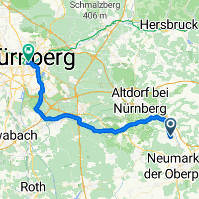
Other popular routes starting in Pilsach
 Laaber - Habsberg
- Distance
- 23.2 km
- Ascent
- 274 m
- Descent
- 279 m
- Location
- Pilsach, Bavaria, Germany
 Deining - Gardersee - Via Claudio Augusta
- Distance
- 622.4 km
- Ascent
- 6,963 m
- Descent
- 7,454 m
- Location
- Pilsach, Bavaria, Germany
 SLA: Entlang der gesamten Schwarzen Laber
- Distance
- 71.7 km
- Ascent
- 165 m
- Descent
- 353 m
- Location
- Pilsach, Bavaria, Germany
 Busradtour_kanal_20160528_kettenbach-ludwig-main_mdk_dietfurt_ueber_altmühl
- Distance
- 50.6 km
- Ascent
- 59 m
- Descent
- 113 m
- Location
- Pilsach, Bavaria, Germany
 Jedermann 2015 Rad
- Distance
- 69.5 km
- Ascent
- 455 m
- Descent
- 503 m
- Location
- Pilsach, Bavaria, Germany
 Pilsach-Oberölsbach
- Distance
- 9.9 km
- Ascent
- 81 m
- Descent
- 137 m
- Location
- Pilsach, Bavaria, Germany
 Tour 6 - Altdorf/Litzlohe
- Distance
- 51.7 km
- Ascent
- 611 m
- Descent
- 610 m
- Location
- Pilsach, Bavaria, Germany
 2. Etappe - Berg/NM-NBG
- Distance
- 41.2 km
- Ascent
- 136 m
- Descent
- 238 m
- Location
- Pilsach, Bavaria, Germany
Open it in the app