

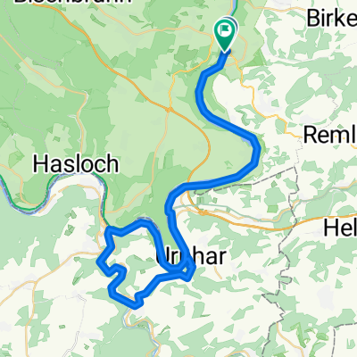
Triefenstein, Germany / Wörth am Main, Allemagne
A cycling route starting in Marktheidenfeld, Bavaria, Germany.
Overview
About this route
Campingplatz Mainruh
landstraße 85, 63939 Wörth am Main, Allemagne
campingplatzmainruh.de
- -:--
- Duration
- 69.6 km
- Distance
- 82 m
- Ascent
- 134 m
- Descent
- ---
- Avg. speed
- ---
- Max. altitude

Route quality
Waytypes & surfaces along the route
Waytypes
Path
17.4 km
(25 %)
Track
16 km
(23 %)
Surfaces
Paved
67.5 km
(97 %)
Unpaved
0.7 km
(1 %)
Asphalt
65.5 km
(94 %)
Paved (undefined)
1.4 km
(2 %)
Continue with Bikemap
Use, edit, or download this cycling route
You would like to ride Triefenstein, Germany / Wörth am Main, Allemagne or customize it for your own trip? Here is what you can do with this Bikemap route:
Free features
- Save this route as favorite or in collections
- Copy & plan your own version of this route
- Sync your route with Garmin or Wahoo
Premium features
Free trial for 3 days, or one-time payment. More about Bikemap Premium.
- Navigate this route on iOS & Android
- Export a GPX / KML file of this route
- Create your custom printout (try it for free)
- Download this route for offline navigation
Discover more Premium features.
Get Bikemap PremiumFrom our community
Other popular routes starting in Marktheidenfeld
 5. Main 2019
- Distance
- 56.7 km
- Ascent
- 85 m
- Descent
- 97 m
- Location
- Marktheidenfeld, Bavaria, Germany
 Martinsbräu Tour 2012
- Distance
- 81.4 km
- Ascent
- 1,163 m
- Descent
- 1,158 m
- Location
- Marktheidenfeld, Bavaria, Germany
 Radtour Main Version1.2
- Distance
- 88.2 km
- Ascent
- 533 m
- Descent
- 564 m
- Location
- Marktheidenfeld, Bavaria, Germany
 Mainschleife
- Distance
- 91.9 km
- Ascent
- 996 m
- Descent
- 908 m
- Location
- Marktheidenfeld, Bavaria, Germany
 Drei-Länder-Tour
- Distance
- 47.7 km
- Ascent
- 514 m
- Descent
- 461 m
- Location
- Marktheidenfeld, Bavaria, Germany
 Marktheidenfeld-Urphar
- Distance
- 52.6 km
- Ascent
- 787 m
- Descent
- 794 m
- Location
- Marktheidenfeld, Bavaria, Germany
 11.07.28 Rettersheim-Grünmorsbach (11. Etappe)
- Distance
- 95.7 km
- Ascent
- 303 m
- Descent
- 270 m
- Location
- Marktheidenfeld, Bavaria, Germany
 5. Etappe: Marktheidenfeld - Hüttenheim
- Distance
- 67.3 km
- Ascent
- 367 m
- Descent
- 238 m
- Location
- Marktheidenfeld, Bavaria, Germany
Open it in the app