

mun to inns
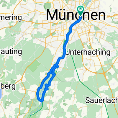
A cycling route starting in Munich, Bavaria, Germany.
Overview
About this route
- -:--
- Duration
- 150 km
- Distance
- 636 m
- Ascent
- 578 m
- Descent
- ---
- Avg. speed
- ---
- Max. altitude

Route quality
Waytypes & surfaces along the route
Waytypes
Track
45 km
(30 %)
Quiet road
42 km
(28 %)
Surfaces
Paved
124.5 km
(83 %)
Unpaved
16.5 km
(11 %)
Asphalt
123 km
(82 %)
Gravel
10.5 km
(7 %)
Continue with Bikemap
Use, edit, or download this cycling route
You would like to ride mun to inns or customize it for your own trip? Here is what you can do with this Bikemap route:
Free features
- Save this route as favorite or in collections
- Copy & plan your own version of this route
- Split it into stages to create a multi-day tour
- Sync your route with Garmin or Wahoo
Premium features
Free trial for 3 days, or one-time payment. More about Bikemap Premium.
- Navigate this route on iOS & Android
- Export a GPX / KML file of this route
- Create your custom printout (try it for free)
- Download this route for offline navigation
Discover more Premium features.
Get Bikemap PremiumFrom our community
Other popular routes starting in Munich
 Alpen 01 München-Tölz
- Distance
- 58 km
- Ascent
- 242 m
- Descent
- 134 m
- Location
- Munich, Bavaria, Germany
 München- Woflrathshausen
- Distance
- 31.3 km
- Ascent
- 246 m
- Descent
- 190 m
- Location
- Munich, Bavaria, Germany
 bikedress "La Primavera" MSR Gruppenausfahrt 19.3.2016
- Distance
- 126 km
- Ascent
- 604 m
- Descent
- 600 m
- Location
- Munich, Bavaria, Germany
 München - Tölz - Königsdorf - München
- Distance
- 124.7 km
- Ascent
- 589 m
- Descent
- 587 m
- Location
- Munich, Bavaria, Germany
 bikedress Burschen-Rennen 26.7.2015
- Distance
- 140.7 km
- Ascent
- 547 m
- Descent
- 546 m
- Location
- Munich, Bavaria, Germany
 münchen - miesbach
- Distance
- 106.6 km
- Ascent
- 422 m
- Descent
- 422 m
- Location
- Munich, Bavaria, Germany
 Isar Süd Trainings Klassiker
- Distance
- 48.2 km
- Ascent
- 345 m
- Descent
- 345 m
- Location
- Munich, Bavaria, Germany
 M - STA - Schäftlarn - OHA - M
- Distance
- 110.1 km
- Ascent
- 602 m
- Descent
- 523 m
- Location
- Munich, Bavaria, Germany
Open it in the app