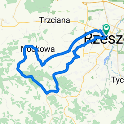
02.06.2019 Tour de Podkarpacie cz. IV
A cycling route starting in Rzesz贸w, Subcarpathian Voivodeship, Poland.
Overview
About this route
- -:--
- Duration
- 107.7 km
- Distance
- 758 m
- Ascent
- 747 m
- Descent
- ---
- Avg. speed
- ---
- Avg. speed
Route quality
Waytypes & surfaces along the route
Waytypes
Road
54.2 km
(50 %)
Quiet road
27.4 km
(25 %)
Surfaces
Paved
98.7 km
(92 %)
Unpaved
0.2 km
(<1 %)
Asphalt
98.7 km
(92 %)
Unpaved (undefined)
0.2 km
(<1 %)
Undefined
8.7 km
(8 %)
Route highlights
Points of interest along the route
Point of interest after 16.6 km
Krzy偶 Milenijny. Punkt Widokowy. Zadaszona wiata.
Point of interest after 67.6 km
Najd艂u偶szy tunel kolejki w膮skotorowej w Europie o d艂ugo艣ci 602 metr贸w.
Point of interest after 88.8 km
Stary M艂yn w Albigowej. PIZZERIA W STARYM M艁YNIE Mo偶liwo艣膰 wykupienia pit stopu dla uczestnik贸w.
Continue with Bikemap
Use, edit, or download this cycling route
You would like to ride 02.06.2019 Tour de Podkarpacie cz. IV or customize it for your own trip? Here is what you can do with this Bikemap route:
Free features
- Save this route as favorite or in collections
- Copy & plan your own version of this route
- Sync your route with Garmin or Wahoo
Premium features
Free trial for 3 days, or one-time payment. More about Bikemap Premium.
- Navigate this route on iOS & Android
- Export a GPX / KML file of this route
- Create your custom printout (try it for free)
- Download this route for offline navigation
Discover more Premium features.
Get Bikemap PremiumFrom our community
Other popular routes starting in Rzesz贸w
- Trasa 2
- Distance
- 14.9 km
- Ascent
- 14 m
- Descent
- 13 m
- Location
- Rzesz贸w, Subcarpathian Voivodeship, Poland
- Objazd Wis艂oka nocom, gdzie 偶abole rechocom
- Distance
- 15.7 km
- Ascent
- 44 m
- Descent
- 41 m
- Location
- Rzesz贸w, Subcarpathian Voivodeship, Poland
- Rzesz贸w, Terliczka, Czarna, 艁a艅cut, Kraczkowa, Malawa, Rzesz贸w
- Distance
- 43 km
- Ascent
- 119 m
- Descent
- 122 m
- Location
- Rzesz贸w, Subcarpathian Voivodeship, Poland
- [V] #054 Babia G贸ra
- Distance
- 38.4 km
- Ascent
- 220 m
- Descent
- 219 m
- Location
- Rzesz贸w, Subcarpathian Voivodeship, Poland
- Rzesz贸w - Dyn贸w po g贸rkach
- Distance
- 94 km
- Ascent
- 857 m
- Descent
- 846 m
- Location
- Rzesz贸w, Subcarpathian Voivodeship, Poland
- Rzesz贸w Skandia Maraton Lang Team 2010 Medio
- Distance
- 50.7 km
- Ascent
- 762 m
- Descent
- 768 m
- Location
- Rzesz贸w, Subcarpathian Voivodeship, Poland
- Trasa na niedziel臋
- Distance
- 48.8 km
- Ascent
- 155 m
- Descent
- 156 m
- Location
- Rzesz贸w, Subcarpathian Voivodeship, Poland
- Rzesz贸w Skandia Maraton Lang Team 2010 Mini
- Distance
- 31.1 km
- Ascent
- 477 m
- Descent
- 480 m
- Location
- Rzesz贸w, Subcarpathian Voivodeship, Poland
Open it in the app