

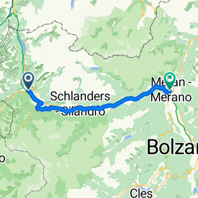
VCA 8: Glorenza-Müstair-Glorenza
A cycling route starting in Glurns, Trentino-Alto Adige, Italy.
Overview
About this route
Petita excursió fora de la VCA (via Clàudia Augusta) per visitar el monasteri benedictí de Sant Joan, a Müstair (Suïssa).
- -:--
- Duration
- 24.3 km
- Distance
- 395 m
- Ascent
- 397 m
- Descent
- ---
- Avg. speed
- ---
- Max. altitude

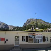
Route photos


Route quality
Waytypes & surfaces along the route
Waytypes
Track
12.4 km
(51 %)
Quiet road
4.4 km
(18 %)
Surfaces
Paved
10.2 km
(42 %)
Unpaved
10.4 km
(43 %)
Gravel
10.4 km
(43 %)
Asphalt
9.5 km
(39 %)
Continue with Bikemap
Use, edit, or download this cycling route
You would like to ride VCA 8: Glorenza-Müstair-Glorenza or customize it for your own trip? Here is what you can do with this Bikemap route:
Free features
- Save this route as favorite or in collections
- Copy & plan your own version of this route
- Sync your route with Garmin or Wahoo
Premium features
Free trial for 3 days, or one-time payment. More about Bikemap Premium.
- Navigate this route on iOS & Android
- Export a GPX / KML file of this route
- Create your custom printout (try it for free)
- Download this route for offline navigation
Discover more Premium features.
Get Bikemap PremiumFrom our community
Other popular routes starting in Glurns
 Wiesenweg nach Glurns
- Distance
- 12.5 km
- Ascent
- 1,244 m
- Descent
- 172 m
- Location
- Glurns, Trentino-Alto Adige, Italy
 🚴♀️E*Bike🇮🇩 MALS-GLURNS- MERAN
- Distance
- 61 km
- Ascent
- 62 m
- Descent
- 682 m
- Location
- Glurns, Trentino-Alto Adige, Italy
 PASS DAL FUORN/ OFENPASS (por Glurns/ Glorenza)
- Distance
- 28.6 km
- Ascent
- 1,396 m
- Descent
- 156 m
- Location
- Glurns, Trentino-Alto Adige, Italy
 20140617_095125.gpx
- Distance
- 61.1 km
- Ascent
- 50 m
- Descent
- 659 m
- Location
- Glurns, Trentino-Alto Adige, Italy
 GDS - BDS: 05 Glurns - Nauders (15 Schlinigpass, Uina-Schlucht xxxxx)
- Distance
- 56.3 km
- Ascent
- 1,829 m
- Descent
- 1,386 m
- Location
- Glurns, Trentino-Alto Adige, Italy
 OrtlerRunde
- Distance
- 314.8 km
- Ascent
- 9,655 m
- Descent
- 9,655 m
- Location
- Glurns, Trentino-Alto Adige, Italy
 Dol Stilfser Joch
- Distance
- 62 km
- Ascent
- 1,836 m
- Descent
- 1,836 m
- Location
- Glurns, Trentino-Alto Adige, Italy
 Glurns nach Melag (Südtirol)
- Distance
- 28.7 km
- Ascent
- 952 m
- Descent
- 47 m
- Location
- Glurns, Trentino-Alto Adige, Italy
Open it in the app