

Italien 2010 Sella Ronda mit Falzarego
A cycling route starting in Abtei-Badia, Trentino-Alto Adige, Italy.
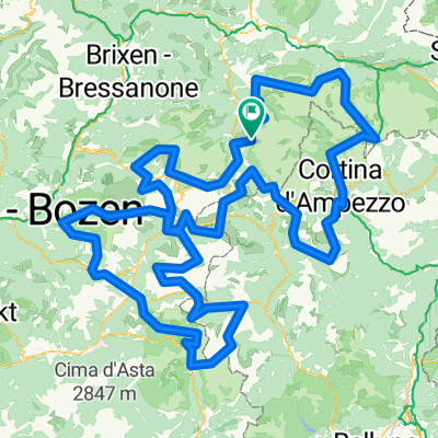
Overview
About this route
Variant of the Sella Ronda with Valparola/Falzarego
- -:--
- Duration
- 82.5 km
- Distance
- 2,836 m
- Ascent
- 2,778 m
- Descent
- ---
- Avg. speed
- 2,249 m
- Max. altitude

Route quality
Waytypes & surfaces along the route
Waytypes
Track
1.6 km
(2 %)
Quiet road
0.8 km
(1 %)
Surfaces
Paved
79.2 km
(96 %)
Unpaved
1.6 km
(2 %)
Asphalt
79.2 km
(96 %)
Gravel
1.6 km
(2 %)
Undefined
1.6 km
(2 %)
Continue with Bikemap
Use, edit, or download this cycling route
You would like to ride Italien 2010 Sella Ronda mit Falzarego or customize it for your own trip? Here is what you can do with this Bikemap route:
Free features
- Save this route as favorite or in collections
- Copy & plan your own version of this route
- Split it into stages to create a multi-day tour
- Sync your route with Garmin or Wahoo
Premium features
Free trial for 3 days, or one-time payment. More about Bikemap Premium.
- Navigate this route on iOS & Android
- Export a GPX / KML file of this route
- Create your custom printout (try it for free)
- Download this route for offline navigation
Discover more Premium features.
Get Bikemap PremiumFrom our community
Other popular routes starting in Abtei-Badia
 Maratona dles Dolomites
- Distance
- 137.5 km
- Ascent
- 3,883 m
- Descent
- 3,539 m
- Location
- Abtei-Badia, Trentino-Alto Adige, Italy
 hotel-linder-neu-groeden-pralongia-hochplateau - proposed
- Distance
- 45.5 km
- Ascent
- 2,099 m
- Descent
- 2,099 m
- Location
- Abtei-Badia, Trentino-Alto Adige, Italy
 Kirche San Leonardo - Kirche Heilig Kreuz
- Distance
- 15.8 km
- Ascent
- 933 m
- Descent
- 933 m
- Location
- Abtei-Badia, Trentino-Alto Adige, Italy
 St. Kassian-Armentarola-Störes-Corvara-St. Kassian
- Distance
- 23.2 km
- Ascent
- 822 m
- Descent
- 827 m
- Location
- Abtei-Badia, Trentino-Alto Adige, Italy
 La Villa - Pian dell'Armentara
- Distance
- 20.6 km
- Ascent
- 862 m
- Descent
- 860 m
- Location
- Abtei-Badia, Trentino-Alto Adige, Italy
 Rifugio Genova dal Passo Delle Erbe
- Distance
- 12.9 km
- Ascent
- 560 m
- Descent
- 560 m
- Location
- Abtei-Badia, Trentino-Alto Adige, Italy
 Medalges
- Distance
- 51.8 km
- Ascent
- 2,005 m
- Descent
- 2,003 m
- Location
- Abtei-Badia, Trentino-Alto Adige, Italy
 Dolomites +
- Distance
- 380.4 km
- Ascent
- 11,658 m
- Descent
- 11,668 m
- Location
- Abtei-Badia, Trentino-Alto Adige, Italy
Open it in the app