

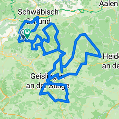
Alb-Extrem_80 km
A cycling route starting in Ottenbach, Baden-Württemberg, Germany.
Overview
About this route
auch noch extrem!
- -:--
- Duration
- 79.4 km
- Distance
- 1,281 m
- Ascent
- 1,290 m
- Descent
- ---
- Avg. speed
- ---
- Avg. speed
Route quality
Waytypes & surfaces along the route
Waytypes
Busy road
25.4 km
(32 %)
Quiet road
25.3 km
(32 %)
Surfaces
Paved
55.8 km
(70 %)
Asphalt
55.4 km
(70 %)
Paved (undefined)
0.4 km
(<1 %)
Undefined
23.6 km
(30 %)
Continue with Bikemap
Use, edit, or download this cycling route
You would like to ride Alb-Extrem_80 km or customize it for your own trip? Here is what you can do with this Bikemap route:
Free features
- Save this route as favorite or in collections
- Copy & plan your own version of this route
- Sync your route with Garmin or Wahoo
Premium features
Free trial for 3 days, or one-time payment. More about Bikemap Premium.
- Navigate this route on iOS & Android
- Export a GPX / KML file of this route
- Create your custom printout (try it for free)
- Download this route for offline navigation
Discover more Premium features.
Get Bikemap PremiumFrom our community
Other popular routes starting in Ottenbach
 Alb Extrem 210 km
- Distance
- 203 km
- Ascent
- 2,999 m
- Descent
- 2,845 m
- Location
- Ottenbach, Baden-Württemberg, Germany
 Albextrem 2013 - 260 km
- Distance
- 265.1 km
- Ascent
- 2,766 m
- Descent
- 2,779 m
- Location
- Ottenbach, Baden-Württemberg, Germany
 Alb Extrem 2007 - 190 km
- Distance
- 189.2 km
- Ascent
- 2,989 m
- Descent
- 2,852 m
- Location
- Ottenbach, Baden-Württemberg, Germany
 Heldenberg über Rehberg
- Distance
- 14.1 km
- Ascent
- 408 m
- Descent
- 228 m
- Location
- Ottenbach, Baden-Württemberg, Germany
 20130630 Alb-Extrem 210km
- Distance
- 207.7 km
- Ascent
- 2,218 m
- Descent
- 2,218 m
- Location
- Ottenbach, Baden-Württemberg, Germany
 tour1
tour1- Distance
- 211.6 km
- Ascent
- 3,154 m
- Descent
- 2,990 m
- Location
- Ottenbach, Baden-Württemberg, Germany
 Alb Extrem 190
- Distance
- 189.7 km
- Ascent
- 2,899 m
- Descent
- 2,776 m
- Location
- Ottenbach, Baden-Württemberg, Germany
 Waldschenke härtere Tour
- Distance
- 14.1 km
- Ascent
- 315 m
- Descent
- 368 m
- Location
- Ottenbach, Baden-Württemberg, Germany
Open it in the app