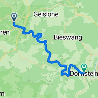
06_Wettelsheim_Rothenburg
A cycling route starting in Treuchtlingen, Bavaria, Germany.
Overview
About this route
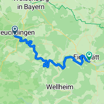
Gefahren am 22. August. Der Altmühltal Radweg endet in Rothenburg! Der Abschnitt Wettelsheim bis Ornbau ist perfekt. Danach ist der Radweg näher an der Straße geführt, aber immer noch gut zu fahren. Ab Colmberg sind wir die Variante über den Colmberg gefahren, angenehmes fahren durch Dörfer und Felder. Ein sehr schöner Radweg.Â
- -:--
- Duration
- 85.8 km
- Distance
- 191 m
- Ascent
- 189 m
- Descent
- ---
- Avg. speed
- ---
- Avg. speed
Route quality
Waytypes & surfaces along the route
Waytypes
Track
31.8 km
(37 %)
Path
20.2 km
(24 %)
Surfaces
Paved
64.8 km
(76 %)
Unpaved
3.6 km
(4 %)
Asphalt
48.3 km
(56 %)
Paving stones
9.1 km
(11 %)
Continue with Bikemap
Use, edit, or download this cycling route
You would like to ride 06_Wettelsheim_Rothenburg or customize it for your own trip? Here is what you can do with this Bikemap route:
Free features
- Save this route as favorite or in collections
- Copy & plan your own version of this route
- Sync your route with Garmin or Wahoo
Premium features
Free trial for 3 days, or one-time payment. More about Bikemap Premium.
- Navigate this route on iOS & Android
- Export a GPX / KML file of this route
- Create your custom printout (try it for free)
- Download this route for offline navigation
Discover more Premium features.
Get Bikemap PremiumFrom our community
Other popular routes starting in Treuchtlingen
- Altmühltal Wettelsheim-Wenzenbach
- Distance
- 191.6 km
- Ascent
- 246 m
- Descent
- 288 m
- Location
- Treuchtlingen, Bavaria, Germany
- wettelsheim - Pappenheim - Solnhofen
- Distance
- 57.8 km
- Ascent
- 3,508 m
- Descent
- 3,512 m
- Location
- Treuchtlingen, Bavaria, Germany
- Wettelsheimer Keller-Runde
- Distance
- 7.2 km
- Ascent
- 115 m
- Descent
- 115 m
- Location
- Treuchtlingen, Bavaria, Germany
- Von Treuchtlingen bis Kinding
- Distance
- 74.7 km
- Ascent
- 792 m
- Descent
- 839 m
- Location
- Treuchtlingen, Bavaria, Germany
- Treuchtlingen - Nürnberg
- Distance
- 71.3 km
- Ascent
- 275 m
- Descent
- 395 m
- Location
- Treuchtlingen, Bavaria, Germany
- Panoramarunde - Altmühltal
- Distance
- 46.8 km
- Ascent
- 858 m
- Descent
- 859 m
- Location
- Treuchtlingen, Bavaria, Germany
- 36_Treuchtlingen – Walting
- Distance
- 56 km
- Ascent
- 222 m
- Descent
- 253 m
- Location
- Treuchtlingen, Bavaria, Germany
- Panoramatour 5 - Treuchtlingen
- Distance
- 46.8 km
- Ascent
- 819 m
- Descent
- 819 m
- Location
- Treuchtlingen, Bavaria, Germany
Open it in the app