Lengfeld und der Otzberg
A cycling route starting in Höchst im Odenwald, Hesse, Germany.
Overview
About this route
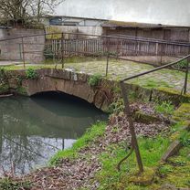
Today I tested the summer route to Umstadt. Not recommended, it's quite overgrown. Lots of nettles and thorns. Rain and sun make everything grow well. From Umstadt I went over to Lengfeld and up to Otzberg towards Hering. From there I went down to Ober-Nauses and then home. #noebike
- -:--
- Duration
- 25.5 km
- Distance
- 358 m
- Ascent
- 376 m
- Descent
- ---
- Avg. speed
- ---
- Max. altitude
Route photos
Continue with Bikemap
Use, edit, or download this cycling route
You would like to ride Lengfeld und der Otzberg or customize it for your own trip? Here is what you can do with this Bikemap route:
Free features
- Save this route as favorite or in collections
- Copy & plan your own version of this route
- Sync your route with Garmin or Wahoo
Premium features
Free trial for 3 days, or one-time payment. More about Bikemap Premium.
- Navigate this route on iOS & Android
- Export a GPX / KML file of this route
- Create your custom printout (try it for free)
- Download this route for offline navigation
Discover more Premium features.
Get Bikemap PremiumFrom our community
Other popular routes starting in Höchst im Odenwald
Lengfeld und der Otzberg- Distance
- 25.5 km
- Ascent
- 358 m
- Descent
- 376 m
- Location
- Höchst im Odenwald, Hesse, Germany
von Brunnen zu Brunnen nach Erbach- Distance
- 43.2 km
- Ascent
- 201 m
- Descent
- 199 m
- Location
- Höchst im Odenwald, Hesse, Germany
zum Schloß Fürstenau- Distance
- 34.7 km
- Ascent
- 246 m
- Descent
- 244 m
- Location
- Höchst im Odenwald, Hesse, Germany
3 Brunnen Runde- Distance
- 31.2 km
- Ascent
- 441 m
- Descent
- 437 m
- Location
- Höchst im Odenwald, Hesse, Germany
über die Hohe Straße- Distance
- 25.3 km
- Ascent
- 377 m
- Descent
- 373 m
- Location
- Höchst im Odenwald, Hesse, Germany
Wald-Amorbach Runde- Distance
- 21.8 km
- Ascent
- 579 m
- Descent
- 580 m
- Location
- Höchst im Odenwald, Hesse, Germany
zum Obernburger Waldhaus- Distance
- 35.6 km
- Ascent
- 327 m
- Descent
- 324 m
- Location
- Höchst im Odenwald, Hesse, Germany
zum Biergarten nach Umscht- Distance
- 30.8 km
- Ascent
- 470 m
- Descent
- 465 m
- Location
- Höchst im Odenwald, Hesse, Germany
Open it in the app


