

Agger, Lenne, Ruhr, Rhein
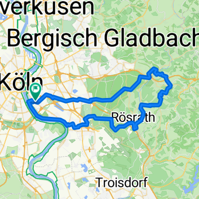
A cycling route starting in Poll, North Rhine-Westphalia, Germany.
Overview
About this route
- -:--
- Duration
- 493.1 km
- Distance
- 951 m
- Ascent
- 950 m
- Descent
- ---
- Avg. speed
- ---
- Max. altitude
Route quality
Waytypes & surfaces along the route
Waytypes
Path
172.6 km
(35 %)
Quiet road
98.6 km
(20 %)
Surfaces
Paved
364.9 km
(74 %)
Unpaved
69 km
(14 %)
Asphalt
350.1 km
(71 %)
Gravel
59.2 km
(12 %)
Route highlights
Points of interest along the route
Accommodation after 89.6 km
Camping Sonderner Kopf
Drinking water after 157.8 km
Lennequelle
Accommodation after 161.4 km
Camping Winterberg
Drinking water after 167.2 km
Ruhrquelle
Accommodation after 267.9 km
Haus Ruhrbrücke
Accommodation after 364.5 km
Camping Essen-Werden
Continue with Bikemap
Use, edit, or download this cycling route
You would like to ride Agger, Lenne, Ruhr, Rhein or customize it for your own trip? Here is what you can do with this Bikemap route:
Free features
- Save this route as favorite or in collections
- Copy & plan your own version of this route
- Split it into stages to create a multi-day tour
- Sync your route with Garmin or Wahoo
Premium features
Free trial for 3 days, or one-time payment. More about Bikemap Premium.
- Navigate this route on iOS & Android
- Export a GPX / KML file of this route
- Create your custom printout (try it for free)
- Download this route for offline navigation
Discover more Premium features.
Get Bikemap PremiumFrom our community
Other popular routes starting in Poll
 Rund um Köln
- Distance
- 43.1 km
- Ascent
- 104 m
- Descent
- 108 m
- Location
- Poll, North Rhine-Westphalia, Germany
 Poll-Hohkeppel-Altenrath-Poll
- Distance
- 74.5 km
- Ascent
- 289 m
- Descent
- 291 m
- Location
- Poll, North Rhine-Westphalia, Germany
 Lengthy ride from április 30. 12:03
- Distance
- 36.5 km
- Ascent
- 67 m
- Descent
- 67 m
- Location
- Poll, North Rhine-Westphalia, Germany
 Festungsring Köln
- Distance
- 63.2 km
- Ascent
- 120 m
- Descent
- 122 m
- Location
- Poll, North Rhine-Westphalia, Germany
 Köln - Frechen - Horrem - Margarethenhöhe - Köln
- Distance
- 51.4 km
- Ascent
- 143 m
- Descent
- 106 m
- Location
- Poll, North Rhine-Westphalia, Germany
 Bergische Trainingsrunde II
- Distance
- 83 km
- Ascent
- 840 m
- Descent
- 833 m
- Location
- Poll, North Rhine-Westphalia, Germany
 Route in Köln
- Distance
- 34.2 km
- Ascent
- 69 m
- Descent
- 68 m
- Location
- Poll, North Rhine-Westphalia, Germany
 65 Gravel Köfo Immek.Heiligenhs.Hoffngthal
- Distance
- 63.6 km
- Ascent
- 1,032 m
- Descent
- 1,031 m
- Location
- Poll, North Rhine-Westphalia, Germany
Open it in the app