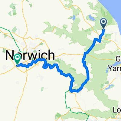
Waxham Sands to Sugar'n Spice Café at Bacton and return
A cycling route starting in Martham, England, United Kingdom.
Overview
About this route
Moderately Quiet Route
- -:--
- Duration
- 52.9 km
- Distance
- 121 m
- Ascent
- 121 m
- Descent
- ---
- Avg. speed
- ---
- Max. altitude
Route quality
Waytypes & surfaces along the route
Waytypes
Road
25.4 km
(48 %)
Quiet road
24.9 km
(47 %)
Surfaces
Paved
15.3 km
(29 %)
Asphalt
15.3 km
(29 %)
Undefined
37.6 km
(71 %)
Continue with Bikemap
Use, edit, or download this cycling route
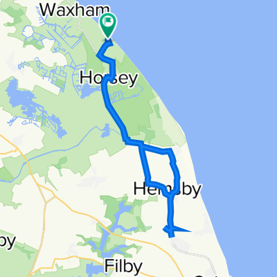
You would like to ride Waxham Sands to Sugar'n Spice Café at Bacton and return or customize it for your own trip? Here is what you can do with this Bikemap route:
Free features
- Save this route as favorite or in collections
- Copy & plan your own version of this route
- Sync your route with Garmin or Wahoo
Premium features
Free trial for 3 days, or one-time payment. More about Bikemap Premium.
- Navigate this route on iOS & Android
- Export a GPX / KML file of this route
- Create your custom printout (try it for free)
- Download this route for offline navigation
Discover more Premium features.
Get Bikemap PremiumFrom our community
Other popular routes starting in Martham
- Waxham Sands to Rose Tavern with detour to George Borrow Road
- Distance
- 47.7 km
- Ascent
- 106 m
- Descent
- 79 m
- Location
- Martham, England, United Kingdom
- Hall Cottages 2, Horsey to Hall Cottages 2, Horsey
- Distance
- 31.3 km
- Ascent
- 59 m
- Descent
- 60 m
- Location
- Martham, England, United Kingdom
- Horsey, Great Yarmouth to 41 Trinity St, Norwich
- Distance
- 48.3 km
- Ascent
- 209 m
- Descent
- 181 m
- Location
- Martham, England, United Kingdom
- Recovered Route
- Distance
- 35.3 km
- Ascent
- 85 m
- Descent
- 83 m
- Location
- Martham, England, United Kingdom
- Thurne loop 50 k
- Distance
- 56.9 km
- Ascent
- 70 m
- Descent
- 70 m
- Location
- Martham, England, United Kingdom
- Horsey loop
- Distance
- 30.7 km
- Ascent
- 37 m
- Descent
- 40 m
- Location
- Martham, England, United Kingdom
- Horsey 5.25 miles
- Distance
- 8.4 km
- Ascent
- 0 m
- Descent
- 0 m
- Location
- Martham, England, United Kingdom
- Village route
- Distance
- 17.5 km
- Ascent
- 52 m
- Descent
- 49 m
- Location
- Martham, England, United Kingdom
Open it in the app