

Lüderenalp Tour
A cycling route starting in Luthern, Canton of Lucerne, Switzerland.
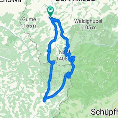
Overview
About this route
to the Bike Hotel > www.kroneluthern.ch
This tour is a must for every biker and at the same time a challenge.
Starting from the Bike Hotel Krone, you leave the village following the Schwarzenbach in the direction of Nesslisboden. After about 3 km, you can take another look back down to the start before crossing the first horizon at Ahorn and at the same time the cantonal border LU/BE.
The descent via Fritzeflue to Wasen is peppered with wonderful single trails. After the finger muscles have been put to the test, it’s now the thighs' turn as the next destination is Lüdernalp (1141 m above sea level). A mountain path then leads to Egg and from there a long descent through Gohl to the lowest point of the tour at 716 m above sea level. From here you can make a detour to nearby Bärau or Langnau i.E. The tour continues through the valley past Wallestullen and Bach into Trub. Now follows a long ascent along the stream of Fankhausbach to Mettlenalp.
Hopefully, you still have enough strength to enjoy the last steep climb to the highest point of the tour at Stächelegg (1304 m above sea level).
(If you want to top this kingly stage, take a detour from here to the highest point in the Emmental, the Napf. This is likely the most accessible route to the Napf, and the amazing view will reward you for your efforts.)
After leaving the canton of Bern at Stächelegg, wonderful single trails and forest sections will accompany you down to Änzibach. After crossing the stream, a forest road winds its way to Mülibühl.
With the Napf at your back and the evening sun on your face, you arrive at Luthern-Dorf with empty muscles but full mental batteries.
- -:--
- Duration
- 66.4 km
- Distance
- 1,702 m
- Ascent
- 1,702 m
- Descent
- ---
- Avg. speed
- ---
- Max. altitude
Continue with Bikemap
Use, edit, or download this cycling route
You would like to ride Lüderenalp Tour or customize it for your own trip? Here is what you can do with this Bikemap route:
Free features
- Save this route as favorite or in collections
- Copy & plan your own version of this route
- Sync your route with Garmin or Wahoo
Premium features
Free trial for 3 days, or one-time payment. More about Bikemap Premium.
- Navigate this route on iOS & Android
- Export a GPX / KML file of this route
- Create your custom printout (try it for free)
- Download this route for offline navigation
Discover more Premium features.
Get Bikemap PremiumFrom our community
Other popular routes starting in Luthern
 A04 Hergiswil Napf
- Distance
- 25.8 km
- Ascent
- 578 m
- Descent
- 577 m
- Location
- Luthern, Canton of Lucerne, Switzerland
 Mettlen Tour
- Distance
- 32.5 km
- Ascent
- 880 m
- Descent
- 875 m
- Location
- Luthern, Canton of Lucerne, Switzerland
 Fritzefluh Tour
- Distance
- 39.5 km
- Ascent
- 871 m
- Descent
- 868 m
- Location
- Luthern, Canton of Lucerne, Switzerland
 Oberlehn - Tour
- Distance
- 38 km
- Ascent
- 791 m
- Descent
- 791 m
- Location
- Luthern, Canton of Lucerne, Switzerland
 Änzi Tour
- Distance
- 20.7 km
- Ascent
- 639 m
- Descent
- 636 m
- Location
- Luthern, Canton of Lucerne, Switzerland
 Scheidegg, Napf, Luthern Bad, Chrutzi
- Distance
- 18 km
- Ascent
- 889 m
- Descent
- 895 m
- Location
- Luthern, Canton of Lucerne, Switzerland
 Scheidegg Tour
- Distance
- 17.7 km
- Ascent
- 564 m
- Descent
- 559 m
- Location
- Luthern, Canton of Lucerne, Switzerland
 Napf - Hergiswil
- Distance
- 13.2 km
- Ascent
- 78 m
- Descent
- 823 m
- Location
- Luthern, Canton of Lucerne, Switzerland
Open it in the app