
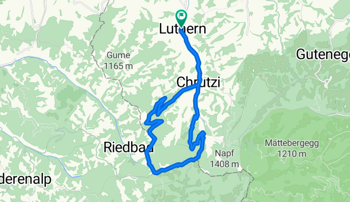
Änzi Tour
A cycling route starting in Luthern, Canton of Lucerne, Switzerland.
Overview
About this route
zum Bikehotel > www.kroneluthern.ch
This short loop shows you the farthest and southernmost part of the long Luthertal.
The route takes you out of the village towards Napf, after about 2 km a road turns right into a side valley, which will take you along the Längenbach to the Gross Scheidegg.
There, the tour dives into a beautiful forest path. At first, you are accompanied by views towards the north and after reaching the watershed, a window opens up, with wonderful views of the Bernese Alps, more and more, so that you perceive the effort as a beautiful pain.
Treat yourself to a break at Hochänzi and enjoy the peace and absolute freedom.
Now begins the initially steep but increasingly gentler descent to Nideränzi, Badegg, Luthern-Bad, and back to the Bike-Hotel Krone in Luthern-Dorf.
- -:--
- Duration
- 20.7 km
- Distance
- 639 m
- Ascent
- 636 m
- Descent
- ---
- Avg. speed
- ---
- Max. altitude
Continue with Bikemap
Use, edit, or download this cycling route
You would like to ride Änzi Tour or customize it for your own trip? Here is what you can do with this Bikemap route:
Free features
- Save this route as favorite or in collections
- Copy & plan your own version of this route
- Sync your route with Garmin or Wahoo
Premium features
Free trial for 3 days, or one-time payment. More about Bikemap Premium.
- Navigate this route on iOS & Android
- Export a GPX / KML file of this route
- Create your custom printout (try it for free)
- Download this route for offline navigation
Discover more Premium features.
Get Bikemap PremiumFrom our community
Other popular routes starting in Luthern
 Napf-Luzern
- Distance
- 39.8 km
- Ascent
- 199 m
- Descent
- 1,161 m
- Location
- Luthern, Canton of Lucerne, Switzerland
 Napf - Hergiswil
- Distance
- 13.2 km
- Ascent
- 78 m
- Descent
- 823 m
- Location
- Luthern, Canton of Lucerne, Switzerland
 Napfrundfahrt
- Distance
- 107 km
- Ascent
- 897 m
- Descent
- 897 m
- Location
- Luthern, Canton of Lucerne, Switzerland
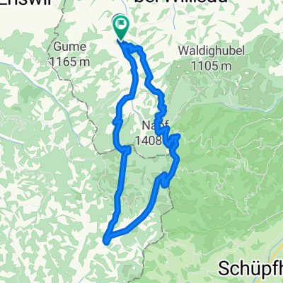 Mettlen Tour
- Distance
- 32.5 km
- Ascent
- 880 m
- Descent
- 875 m
- Location
- Luthern, Canton of Lucerne, Switzerland
 Fritzefluh Tour
- Distance
- 39.5 km
- Ascent
- 871 m
- Descent
- 868 m
- Location
- Luthern, Canton of Lucerne, Switzerland
 Scheidegg, Napf, Luthern Bad, Chrutzi
- Distance
- 18 km
- Ascent
- 889 m
- Descent
- 895 m
- Location
- Luthern, Canton of Lucerne, Switzerland
 Scheidegg Tour
- Distance
- 17.7 km
- Ascent
- 564 m
- Descent
- 559 m
- Location
- Luthern, Canton of Lucerne, Switzerland
 Oberlehn - Tour
- Distance
- 38 km
- Ascent
- 791 m
- Descent
- 791 m
- Location
- Luthern, Canton of Lucerne, Switzerland
Open it in the app