

Ahornalp-Luthern
A cycling route starting in Luthern, Canton of Lucerne, Switzerland.
Overview
About this route
Proposed route
- -:--
- Duration
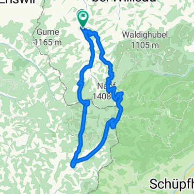
- 7.4 km
- Distance
- 41 m
- Ascent
- 400 m
- Descent
- ---
- Avg. speed
- ---
- Max. altitude

Route quality
Waytypes & surfaces along the route
Waytypes
Track
5.3 km
(71 %)
Access road
1.3 km
(18 %)
Surfaces
Paved
4.5 km
(61 %)
Unpaved
1.6 km
(22 %)
Paved (undefined)
4.5 km
(60 %)
Pebblestone
1.3 km
(17 %)
Continue with Bikemap
Use, edit, or download this cycling route
You would like to ride Ahornalp-Luthern or customize it for your own trip? Here is what you can do with this Bikemap route:
Free features
- Save this route as favorite or in collections
- Copy & plan your own version of this route
- Sync your route with Garmin or Wahoo
Premium features
Free trial for 3 days, or one-time payment. More about Bikemap Premium.
- Navigate this route on iOS & Android
- Export a GPX / KML file of this route
- Create your custom printout (try it for free)
- Download this route for offline navigation
Discover more Premium features.
Get Bikemap PremiumFrom our community
Other popular routes starting in Luthern
 Napf - Hergiswil
- Distance
- 13.2 km
- Ascent
- 78 m
- Descent
- 823 m
- Location
- Luthern, Canton of Lucerne, Switzerland
 Scheidegg Tour
- Distance
- 17.7 km
- Ascent
- 564 m
- Descent
- 559 m
- Location
- Luthern, Canton of Lucerne, Switzerland
 Mettlen Tour
- Distance
- 32.5 km
- Ascent
- 880 m
- Descent
- 875 m
- Location
- Luthern, Canton of Lucerne, Switzerland
 Fritzefluh Tour
- Distance
- 39.5 km
- Ascent
- 871 m
- Descent
- 868 m
- Location
- Luthern, Canton of Lucerne, Switzerland
 Scheidegg, Napf, Luthern Bad, Chrutzi
- Distance
- 18 km
- Ascent
- 889 m
- Descent
- 895 m
- Location
- Luthern, Canton of Lucerne, Switzerland
 Oberlehn - Tour
- Distance
- 38 km
- Ascent
- 791 m
- Descent
- 791 m
- Location
- Luthern, Canton of Lucerne, Switzerland
 Napfrundfahrt
- Distance
- 107 km
- Ascent
- 897 m
- Descent
- 897 m
- Location
- Luthern, Canton of Lucerne, Switzerland
 Napf-Luzern
- Distance
- 39.8 km
- Ascent
- 199 m
- Descent
- 1,161 m
- Location
- Luthern, Canton of Lucerne, Switzerland
Open it in the app