

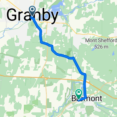
Granby - St-Cezaire
A cycling route starting in Granby, Quebec, Canada.
Overview
About this route
- -:--
- Duration
- 25.9 km
- Distance
- 23 m
- Ascent
- 109 m
- Descent
- ---
- Avg. speed
- ---
- Max. altitude

Route quality
Waytypes & surfaces along the route
Waytypes
Cycleway
22.8 km
(88 %)
Quiet road
1.8 km
(7 %)
Surfaces
Paved
23.3 km
(90 %)
Asphalt
23.3 km
(90 %)
Undefined
2.6 km
(10 %)
Continue with Bikemap
Use, edit, or download this cycling route
You would like to ride Granby - St-Cezaire or customize it for your own trip? Here is what you can do with this Bikemap route:
Free features
- Save this route as favorite or in collections
- Copy & plan your own version of this route
- Sync your route with Garmin or Wahoo
Premium features
Free trial for 3 days, or one-time payment. More about Bikemap Premium.
- Navigate this route on iOS & Android
- Export a GPX / KML file of this route
- Create your custom printout (try it for free)
- Download this route for offline navigation
Discover more Premium features.
Get Bikemap PremiumFrom our community
Other popular routes starting in Granby
 Le grand tour
- Distance
- 13.7 km
- Ascent
- 152 m
- Descent
- 167 m
- Location
- Granby, Quebec, Canada
 waterloo
- Distance
- 14.9 km
- Ascent
- 143 m
- Descent
- 45 m
- Location
- Granby, Quebec, Canada
 Estriade Bike Trail
- Distance
- 46.6 km
- Ascent
- 154 m
- Descent
- 154 m
- Location
- Granby, Quebec, Canada
 Montreal - take 1
- Distance
- 277.7 km
- Ascent
- 1,175 m
- Descent
- 1,175 m
- Location
- Granby, Quebec, Canada
 vers Granby
- Distance
- 18 km
- Ascent
- 70 m
- Descent
- 70 m
- Location
- Granby, Quebec, Canada
 granby-Bromont
- Distance
- 13.1 km
- Ascent
- 99 m
- Descent
- 97 m
- Location
- Granby, Quebec, Canada
 boucle Waterloo-parc Yamaska
- Distance
- 44.9 km
- Ascent
- 274 m
- Descent
- 275 m
- Location
- Granby, Quebec, Canada
 grand tour mont shefford
- Distance
- 47.6 km
- Ascent
- 280 m
- Descent
- 282 m
- Location
- Granby, Quebec, Canada
Open it in the app