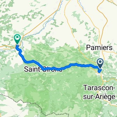
Bpf 09/11 Train : Foix/Lordat/La Fajolle/ St Hilaire
- 272.5 km
- 2,560 m
- 2,765 m
- Foix, Occitanie, France
A cycling route starting in Foix, Occitanie, France.
Overview
In 2019, we did self-supported touring for a little less than 2 months from mid-September through early November.
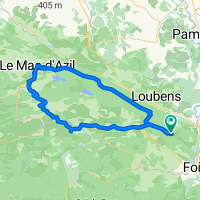
Day 6 - Foix - Circle to Col de Péguère
We've done most of this ride a number of times. D17 from Foix to the Col de Péguère at 1375M (passing the Col des Marrous at 990M and the Col de Jouels at 1247M). This is a wonderful ride with very little in the way of traffic once you pass St-Pierre-de-Rivière. The climb is for the most part relatively gentle with no steep sections above 8%. The view at the top is great, though along the way, the forest prevents much of a view.
D15 was new to us. It was an outstanding well-paved almost zero-traffic one-lane road (the section from D17 down about ten or twelve kilometers) that would be a real challenge climbing. On this ride, we were descending, but look forward to someday climbing up it.
Shortly after reaching D117, we got onto the Voie Verte, which was easy riding with, of course, zero cars. This Voie Verte is not paved, but most of it is pretty good hard pack. Our 700x35 tires have no problem with this. While most of the Voie Verte is in pretty good condition, some of it closer to Foix degenerates into something that's better than a goat path, but not by that much. Racing bikes with narrow tires should be careful on this section...or avoid it by taking D117 which parallels the path for the most part.
This was a great ride that we highly recommend.
created this 6 years ago


Route quality
Road
43.1 km
(56 %)
Cycleway
11.5 km
(15 %)
Paved
53.8 km
(70 %)
Unpaved
13.8 km
(18 %)
Asphalt
53.8 km
(70 %)
Loose gravel
11.5 km
(15 %)
Continue with Bikemap
You would like to ride 2019-06 Foix - Circle to Col de Péguère or customize it for your own trip? Here is what you can do with this Bikemap route:
Free trial for 3 days, or one-time payment. More about Bikemap Premium.
Discover more Premium features.
Get Bikemap PremiumFrom our community
Open it in the app