

Sligo Creek: Colesville Rd to Anacostia River
A cycling route starting in Four Corners, Maryland, United States.
Overview
About this route
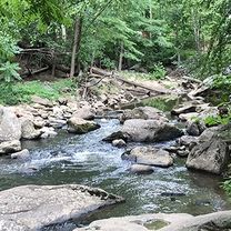
Lots of bridges and some road crossings early on but nice ride; not fast, though. Mid week the trail was very quiet.
- -:--
- Duration
- 14 km
- Distance
- 40 m
- Ascent
- 114 m
- Descent
- ---
- Avg. speed
- ---
- Max. altitude

Route quality
Waytypes & surfaces along the route
Waytypes
Cycleway
13.6 km
(97 %)
Quiet road
0.3 km
(2 %)
Access road
0.1 km
(1 %)
Surfaces
Paved
14 km
(100 %)
Asphalt
12.6 km
(90 %)
Paved (undefined)
0.6 km
(4 %)
Continue with Bikemap
Use, edit, or download this cycling route
You would like to ride Sligo Creek: Colesville Rd to Anacostia River or customize it for your own trip? Here is what you can do with this Bikemap route:
Free features
- Save this route as favorite or in collections
- Copy & plan your own version of this route
- Sync your route with Garmin or Wahoo
Premium features
Free trial for 3 days, or one-time payment. More about Bikemap Premium.
- Navigate this route on iOS & Android
- Export a GPX / KML file of this route
- Create your custom printout (try it for free)
- Download this route for offline navigation
Discover more Premium features.
Get Bikemap PremiumFrom our community
Other popular routes starting in Four Corners
 9800 Hastings Dr, Silver Spring to 122 Hilltop Rd, Silver Spring
- Distance
- 4.4 km
- Ascent
- 19 m
- Descent
- 54 m
- Location
- Four Corners, Maryland, United States
 SSIMS from South Four Corners
- Distance
- 2.5 km
- Ascent
- 26 m
- Descent
- 31 m
- Location
- Four Corners, Maryland, United States
 Silver Spring to Bladensburg via Sligo Creek Trail
- Distance
- 14.2 km
- Ascent
- 32 m
- Descent
- 109 m
- Location
- Four Corners, Maryland, United States
 Historic Homes and Urban Nature Trails Ride
- Distance
- 12.5 km
- Ascent
- 78 m
- Descent
- 95 m
- Location
- Four Corners, Maryland, United States
 National Park Seminary Historic District
- Distance
- 8.1 km
- Ascent
- 92 m
- Descent
- 92 m
- Location
- Four Corners, Maryland, United States
 Dale Drive Station Purple Line
- Distance
- 2.9 km
- Ascent
- 26 m
- Descent
- 41 m
- Location
- Four Corners, Maryland, United States
 Wheaton Mall from South Four Corners
- Distance
- 4.1 km
- Ascent
- 63 m
- Descent
- 41 m
- Location
- Four Corners, Maryland, United States
 Downtown Silver Spring from South Four Corners
- Distance
- 3.1 km
- Ascent
- 34 m
- Descent
- 32 m
- Location
- Four Corners, Maryland, United States
Open it in the app