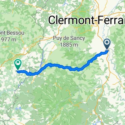
2019-22 Issoire to Pont-du-Château
A cycling route starting in Issoire, Auvergne-Rhône-Alpes, France.
Overview
About this route
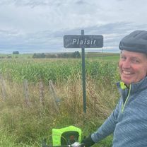
In 2019, we did self-supported touring for a little less than 2 months from mid-September through early November.
Day 22 - Issoire to Pont-du-Château
All roads, with the exception of D2089 into Pont-du-Château, were low-traffic roads with wonderful scenery. This area east of Issoire is definitely worth returning to.
We highly recommend this area and these roads.
- -:--
- Duration
- 41.4 km
- Distance
- 414 m
- Ascent
- 472 m
- Descent
- ---
- Avg. speed
- ---
- Avg. speed
Route photos
Route quality
Waytypes & surfaces along the route
Waytypes
Road
37.8 km
(91 %)
Busy road
2.1 km
(5 %)
Surfaces
Paved
13 km
(31 %)
Unpaved
0 km
(<1 %)
Asphalt
13 km
(31 %)
Gravel
0 km
(<1 %)
Undefined
28.4 km
(69 %)
Continue with Bikemap
Use, edit, or download this cycling route
You would like to ride 2019-22 Issoire to Pont-du-Château or customize it for your own trip? Here is what you can do with this Bikemap route:
Free features
- Save this route as favorite or in collections
- Copy & plan your own version of this route
- Sync your route with Garmin or Wahoo
Premium features
Free trial for 3 days, or one-time payment. More about Bikemap Premium.
- Navigate this route on iOS & Android
- Export a GPX / KML file of this route
- Create your custom printout (try it for free)
- Download this route for offline navigation
Discover more Premium features.
Get Bikemap PremiumFrom our community
Other popular routes starting in Issoire
- Deutschland - Portugal (Berlin - Faro) FR 20 Issoire - Massiac
- Distance
- 55.9 km
- Ascent
- 365 m
- Descent
- 251 m
- Location
- Issoire, Auvergne-Rhône-Alpes, France
- Puy 4 - Issoire
- Distance
- 93.5 km
- Ascent
- 1,137 m
- Descent
- 1,137 m
- Location
- Issoire, Auvergne-Rhône-Alpes, France
- De Impasse de l'Union 6, Issoire à Impasse de l'Union 2, Issoire
- Distance
- 17.5 km
- Ascent
- 387 m
- Descent
- 389 m
- Location
- Issoire, Auvergne-Rhône-Alpes, France
- DA Charity Etape 2011 Day 1
- Distance
- 149.1 km
- Ascent
- 2,371 m
- Descent
- 1,856 m
- Location
- Issoire, Auvergne-Rhône-Alpes, France
- 2019-21 Issoire Circle to St-Martin-des-Plains
- Distance
- 23.5 km
- Ascent
- 132 m
- Descent
- 134 m
- Location
- Issoire, Auvergne-Rhône-Alpes, France
- 2019-20 Issoire Circle toward Condat-lès-Montboissier
- Distance
- 41.7 km
- Ascent
- 619 m
- Descent
- 620 m
- Location
- Issoire, Auvergne-Rhône-Alpes, France
- Montée de la Chapelle sur Usson
- Distance
- 56 km
- Ascent
- 569 m
- Descent
- 574 m
- Location
- Issoire, Auvergne-Rhône-Alpes, France
- issoire
- Distance
- 84.2 km
- Ascent
- 1,023 m
- Descent
- 977 m
- Location
- Issoire, Auvergne-Rhône-Alpes, France
Open it in the app