

Strudengaurunde
A cycling route starting in Nöchling, Lower Austria, Austria.
Overview
About this route
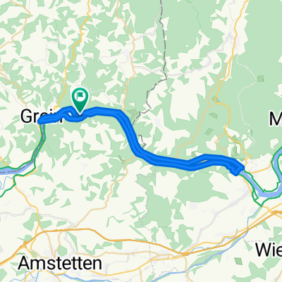
The route runs continuously along the 'Donauradweg' on the left and right banks of the Danube between Grein/Donaubrücke and Ybbs/Donaubrücke. Federal road in the local area of St.Nikola and Sarmingstein about 10%, federal road with multifunctional lanes about 20%, local road about 30%, bike path about 40%
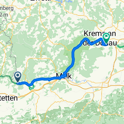
Route description: 0 km The starting point of our Strudengau round is the Gießenbachmühle at the entrance to the Stillensteinklamm, at the western end of the municipality of St. Nikola~Donau. Passing the legendary island of Wörth, we turn left under the castle of Werfenstein into the district of Struden. We pass the Imperial Mauthaus, the former mariner's church of Struden, and the municipal office of St. Nikola. Before we return to the federal road, to the left is the Hausstein chapel, where an inscription is carved into the rock, informing about the blasting of Hausstein (Danube whirl) and the regulation of the Struden. In the district of St. Nikola, we pass the old captain's house and finally cross the Dimbach. High on a rock stands the Parish Church of St. Nikola. Passing the elementary school, we continue our ride towards Sarmingstein. Here we see the branch church and the captain's house. Above the captain's house stands the round tower, which once represented the northern corner of the 'Bastei'. After the Ettlinger inn, we continue through the district of Hirschenau, crossing the border of Lower Austria into Isperdorf and further through the village of Weins to Ybbs-Persenbeug Hydroelectric Power Plant. At the power plant, we cross the Danube and then continue along the right bank of the Danube towards Willersbach and finally, below the Ruins of Freyenstein, along the bike path along the Danube towards Hößgang. On this stretch, we enjoy a splendid view of the municipality of St. Nikola and the districts we passed through at the beginning of the round.
In Wiesen there is the possibility to shorten the Strudengau round and directly ferry to Grein (bike ferry). Otherwise, we ride to the Danube bridge in Grein and cross the Danube here towards Grein. At the end of the round, at the Gießenbachmühle snack station there is the possibility for a refreshment.
- -:--
- Duration
- 39.4 km
- Distance
- 52 m
- Ascent
- 20 m
- Descent
- ---
- Avg. speed
- ---
- Max. altitude

Route quality
Waytypes & surfaces along the route
Waytypes
Access road
7.5 km
(19 %)
Quiet road
5.9 km
(15 %)
Surfaces
Paved
36.6 km
(93 %)
Unpaved
0.4 km
(1 %)
Asphalt
29.2 km
(74 %)
Concrete
7.5 km
(19 %)
Continue with Bikemap
Use, edit, or download this cycling route
You would like to ride Strudengaurunde or customize it for your own trip? Here is what you can do with this Bikemap route:
Free features
- Save this route as favorite or in collections
- Copy & plan your own version of this route
- Sync your route with Garmin or Wahoo
Premium features
Free trial for 3 days, or one-time payment. More about Bikemap Premium.
- Navigate this route on iOS & Android
- Export a GPX / KML file of this route
- Create your custom printout (try it for free)
- Download this route for offline navigation
Discover more Premium features.
Get Bikemap PremiumFrom our community
Other popular routes starting in Nöchling
 4-ik nap Willersbach 38, Freyenstein to Rossatzbach 24
- Distance
- 60.4 km
- Ascent
- 706 m
- Descent
- 746 m
- Location
- Nöchling, Lower Austria, Austria
 Österreichtour 4. Etappe
- Distance
- 141 km
- Ascent
- 408 m
- Descent
- 464 m
- Location
- Nöchling, Lower Austria, Austria
 südl waldviertel
- Distance
- 97.6 km
- Ascent
- 599 m
- Descent
- 601 m
- Location
- Nöchling, Lower Austria, Austria
 Etapa 053B (Ybbs an der Donau - Goldwörth)
- Distance
- 111.3 km
- Ascent
- 734 m
- Descent
- 701 m
- Location
- Nöchling, Lower Austria, Austria
 Strudengaurunde
- Distance
- 39.4 km
- Ascent
- 52 m
- Descent
- 20 m
- Location
- Nöchling, Lower Austria, Austria
 Pasov - BA, 4.etapa (Isperdorf - Krems,Thallern)
- Distance
- 77.3 km
- Ascent
- 328 m
- Descent
- 368 m
- Location
- Nöchling, Lower Austria, Austria
 Neustadtl (Krenn) -Zwentendorf a.d. Donau
- Distance
- 123.8 km
- Ascent
- 250 m
- Descent
- 299 m
- Location
- Nöchling, Lower Austria, Austria
 🧑🤝🧑🧑🤝🧑🇦🇹Wanderung in der Stillensteinklamm im Strudengau 16.09.21. m.🎥
- Distance
- 9 km
- Ascent
- 303 m
- Descent
- 304 m
- Location
- Nöchling, Lower Austria, Austria
Open it in the app