

2019-26 Riom-ès-Montagnes to Aurillac
A cycling route starting in Riom-ès-Montagnes, Auvergne-Rhône-Alpes, France.
Overview
About this route
In 2019, we did self-supported touring for a little less than 2 months from mid-September through early November.
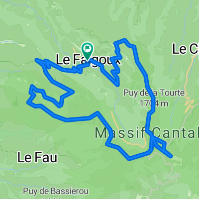
Day 26 - Riom-ès-Montagnes to Aurillac
The ride on D3 was beautiful despite it’s being a relatively major road. Traffic was sparse and we enjoyed the ups and downs. The climb to the Col d’Entremont (1210M) was relatively benign from this direction, with the slope being pretty gentle.
Arriving at D139, which hits D3 several kilometers before Murat, we turned in and found a beautiful road that connected south to Laveissière and a road (D439) that runs parallel to N122.
At Fraisse-Haut, which is just a little west of Laveissière on D439, we found an unnumbered side road that paralleled N122 for a number of kilometers. Taking this narrow single lane chaussée-deformée (but fortunately paved) road, we had a beautiful but very very challenging climb that took us up past a railway bridge and eventually back to N122, not far from the Tunnel du Lioran. I think this was the first time this trip that I actually used my lowest gear on my touring bicycle. We did not try to go through the tunnel (probably it is prohibited for cyclists) and instead climbed further on D67 to the Col de Cère at 1294M, passing several ski areas as we climbed. We had planned to use other smaller side roads after the Col de Cère to avoid being on N122 for much of the remaining mileage to Aurillac, but this climb starting from Fraisse-Haut had been so tough that we figured we’d have to stay on N122 to make sure that we’d get to Aurillac before dark. (Due to last night's time change because of the end of daylight savings time, I think we both through that we had one less hour of daylight remaining. I had not changed the time on our bicycle computers.) In any case, with a few exceptions, most of the remaining ride to Aurillac was downhill, with the first kilometers after rejoining N122 from D67 being a heck of a downhill run. Overall, N122 wasn’t bad as the scenery is great and there wasn’t much traffic until getting within ten kilometers or so of Aurillac. It also occasionally had some road shoulder. We arrived in Aurillac about two hours before sunset, so no problem on timing.
- -:--
- Duration
- 84.9 km
- Distance
- 1,008 m
- Ascent
- 1,223 m
- Descent
- ---
- Avg. speed
- ---
- Max. altitude

Route photos


Route quality
Waytypes & surfaces along the route
Waytypes
Quiet road
8.5 km
(10 %)
Road
6.8 km
(8 %)
Surfaces
Paved
52.6 km
(62 %)
Asphalt
52.6 km
(62 %)
Undefined
32.3 km
(38 %)
Continue with Bikemap
Use, edit, or download this cycling route
You would like to ride 2019-26 Riom-ès-Montagnes to Aurillac or customize it for your own trip? Here is what you can do with this Bikemap route:
Free features
- Save this route as favorite or in collections
- Copy & plan your own version of this route
- Split it into stages to create a multi-day tour
- Sync your route with Garmin or Wahoo
Premium features
Free trial for 3 days, or one-time payment. More about Bikemap Premium.
- Navigate this route on iOS & Android
- Export a GPX / KML file of this route
- Create your custom printout (try it for free)
- Download this route for offline navigation
Discover more Premium features.
Get Bikemap PremiumFrom our community
Other popular routes starting in Riom-ès-Montagnes
 4.etapa Riom-es-Montagnes - Saint-Cirgues-De-Jordanne
- Distance
- 84.3 km
- Ascent
- 1,474 m
- Descent
- 1,454 m
- Location
- Riom-ès-Montagnes, Auvergne-Rhône-Alpes, France
 Cantal 2022 N° 2 bis 103km 2110 D+
- Distance
- 103 km
- Ascent
- 2,461 m
- Descent
- 2,469 m
- Location
- Riom-ès-Montagnes, Auvergne-Rhône-Alpes, France
 Cantal 2022 N°2 80km 1580D+
- Distance
- 80.1 km
- Ascent
- 1,648 m
- Descent
- 1,646 m
- Location
- Riom-ès-Montagnes, Auvergne-Rhône-Alpes, France
 Cantal 2022 N°1 bis 61km
- Distance
- 60.9 km
- Ascent
- 1,396 m
- Descent
- 1,397 m
- Location
- Riom-ès-Montagnes, Auvergne-Rhône-Alpes, France
 12. Etappe: Condat über Pas de Peyrol
- Distance
- 52.6 km
- Ascent
- 1,064 m
- Descent
- 1,154 m
- Location
- Riom-ès-Montagnes, Auvergne-Rhône-Alpes, France
 Le Puy Mary (1783m) et la vallée du Falgoux par les crêtes
- Distance
- 43.9 km
- Ascent
- 1,933 m
- Descent
- 1,934 m
- Location
- Riom-ès-Montagnes, Auvergne-Rhône-Alpes, France
 Cantal 2022 circuit N°1 - 43km samedi aprem
- Distance
- 43.2 km
- Ascent
- 951 m
- Descent
- 954 m
- Location
- Riom-ès-Montagnes, Auvergne-Rhône-Alpes, France
 Trip vélo Cantal - Corrèze 2011
- Distance
- 299.2 km
- Ascent
- 2,021 m
- Descent
- 2,021 m
- Location
- Riom-ès-Montagnes, Auvergne-Rhône-Alpes, France
Open it in the app