

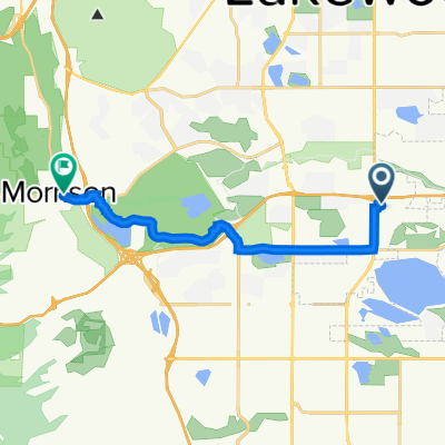
bear creek 470
A cycling route starting in Sheridan, Colorado, United States.
Overview
About this route
- -:--
- Duration
- 50.5 km
- Distance
- 285 m
- Ascent
- 285 m
- Descent
- ---
- Avg. speed
- ---
- Max. altitude

Route quality
Waytypes & surfaces along the route
Waytypes
Cycleway
46.5 km
(92 %)
Quiet road
3.5 km
(7 %)
Undefined
0.5 km
(1 %)
Surfaces
Paved
47 km
(93 %)
Concrete
34.9 km
(69 %)
Paved (undefined)
8.1 km
(16 %)
Continue with Bikemap
Use, edit, or download this cycling route
You would like to ride bear creek 470 or customize it for your own trip? Here is what you can do with this Bikemap route:
Free features
- Save this route as favorite or in collections
- Copy & plan your own version of this route
- Sync your route with Garmin or Wahoo
Premium features
Free trial for 3 days, or one-time payment. More about Bikemap Premium.
- Navigate this route on iOS & Android
- Export a GPX / KML file of this route
- Create your custom printout (try it for free)
- Download this route for offline navigation
Discover more Premium features.
Get Bikemap PremiumFrom our community
Other popular routes starting in Sheridan
 3208 S Patton Ct, Denver to 2554 S Broadway, Denver
- Distance
- 8 km
- Ascent
- 20 m
- Descent
- 55 m
- Location
- Sheridan, Colorado, United States
 bear creek 470
- Distance
- 50.5 km
- Ascent
- 285 m
- Descent
- 285 m
- Location
- Sheridan, Colorado, United States
 River Point Parkway 3602, Sheridan to River Point Parkway 3602, Sheridan
- Distance
- 27.2 km
- Ascent
- 95 m
- Descent
- 82 m
- Location
- Sheridan, Colorado, United States
 West Dartmouth Avenue 6990, Denver to South Valley Road, Littleton
- Distance
- 40 km
- Ascent
- 437 m
- Descent
- 270 m
- Location
- Sheridan, Colorado, United States
 Estes/Winter Park Loop
- Distance
- 378.2 km
- Ascent
- 7,606 m
- Descent
- 7,561 m
- Location
- Sheridan, Colorado, United States
 Sawyer Walk
- Distance
- 4.9 km
- Ascent
- 28 m
- Descent
- 27 m
- Location
- Sheridan, Colorado, United States
 Easy ride in Englewood
- Distance
- 5.9 km
- Ascent
- 52 m
- Descent
- 69 m
- Location
- Sheridan, Colorado, United States
 West Jefferson Avenue 7393, Lakewood to Bear Creek Avenue 117, Morrison
- Distance
- 12.7 km
- Ascent
- 195 m
- Descent
- 101 m
- Location
- Sheridan, Colorado, United States
Open it in the app